Land-use and land-cover annotation

Label buildings, roads, vegetation, water, and other land-cover regions in satellite and aerial imagery. Build reviewed geospatial datasets with consistent classes and source raster geometry.
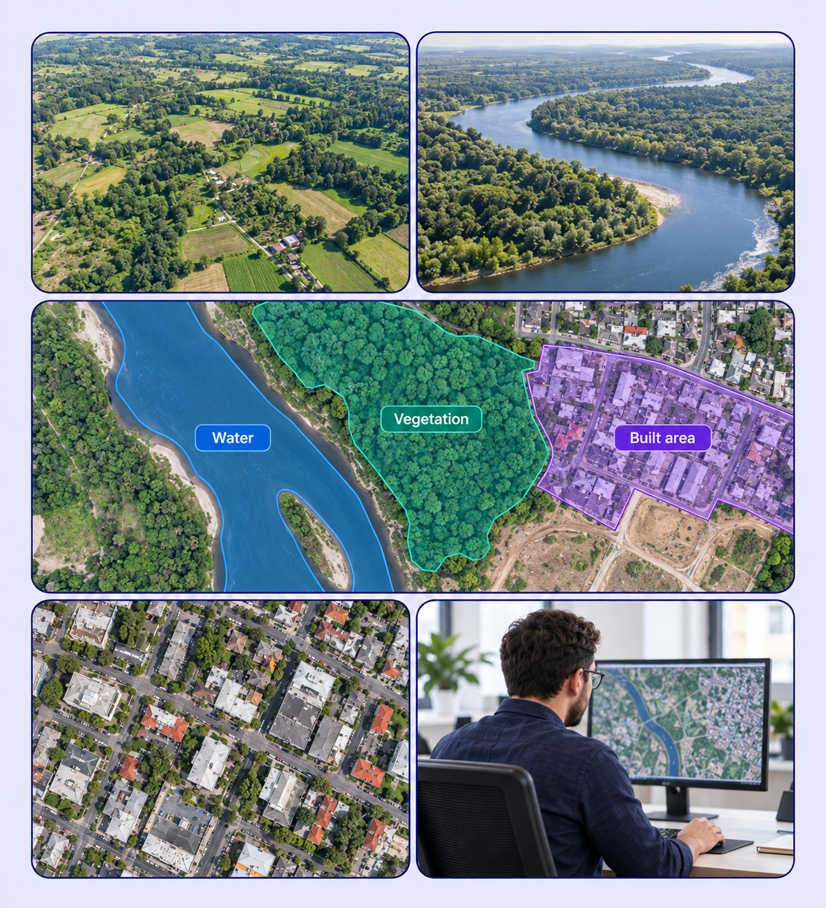
Land Use Classification example with source-data annotations and contextual photographs.

Turn aerial scenes into mapped training labels

Create region and feature annotations that reflect the land classes your model needs to distinguish.
Aerial residential landscape for land-use and land-cover classification.

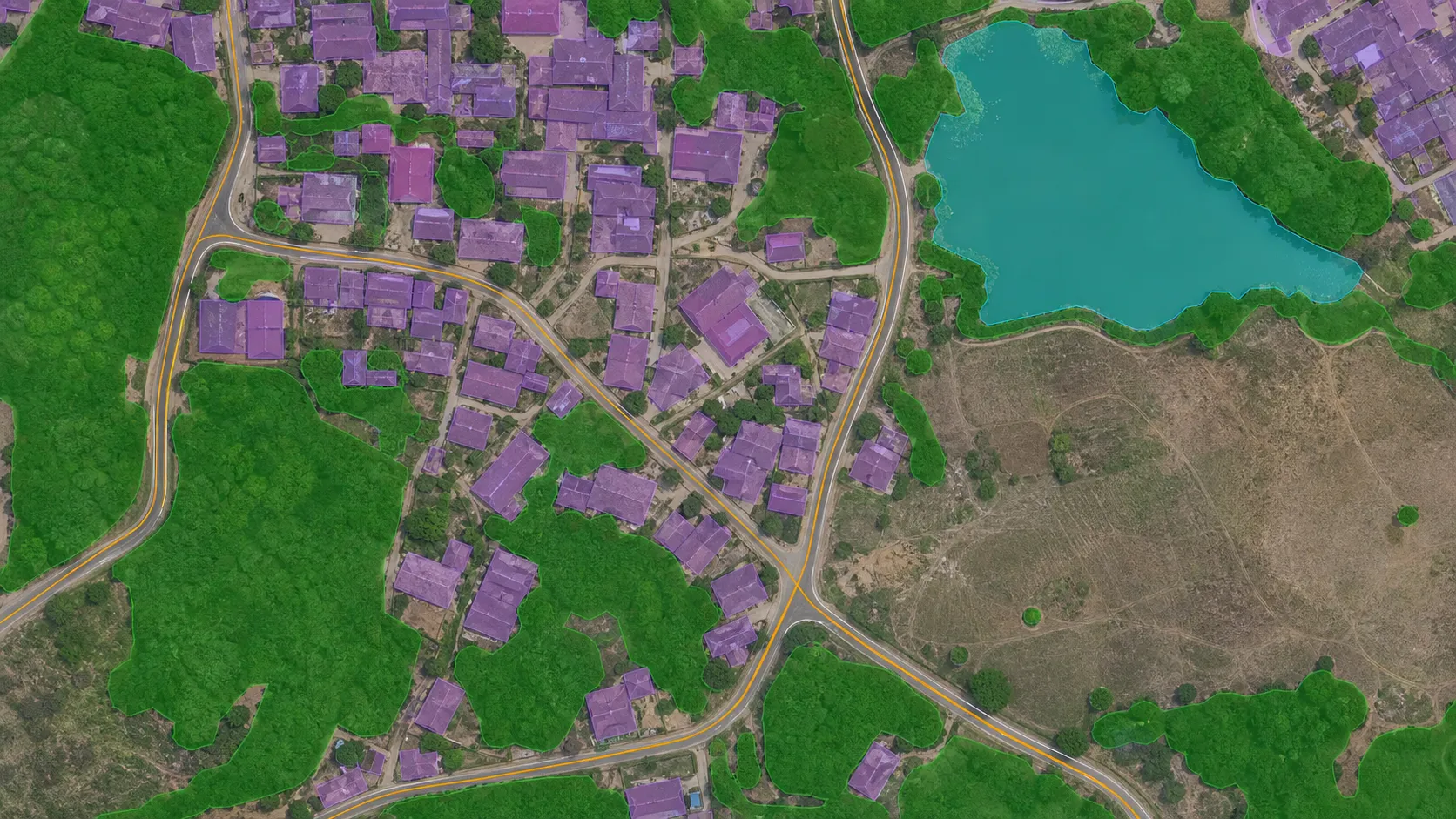
Land-cover region masks

Mark vegetation, water, and built-up regions with the classes defined by your mapping task.
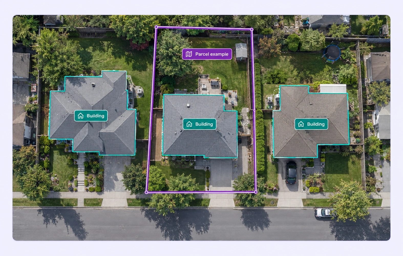
Aerial buildings and a visible parcel example outlined with polygons.

Building and parcel outlines

Outline visible buildings or task-defined parcels to create structured examples for geospatial models.
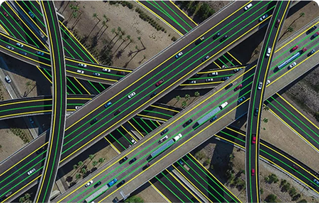
Aerial highway interchange with roads and lanes marked for infrastructure mapping.

Road and linear features

Trace roads and other linear features using labels suited to their shape and mapping role.
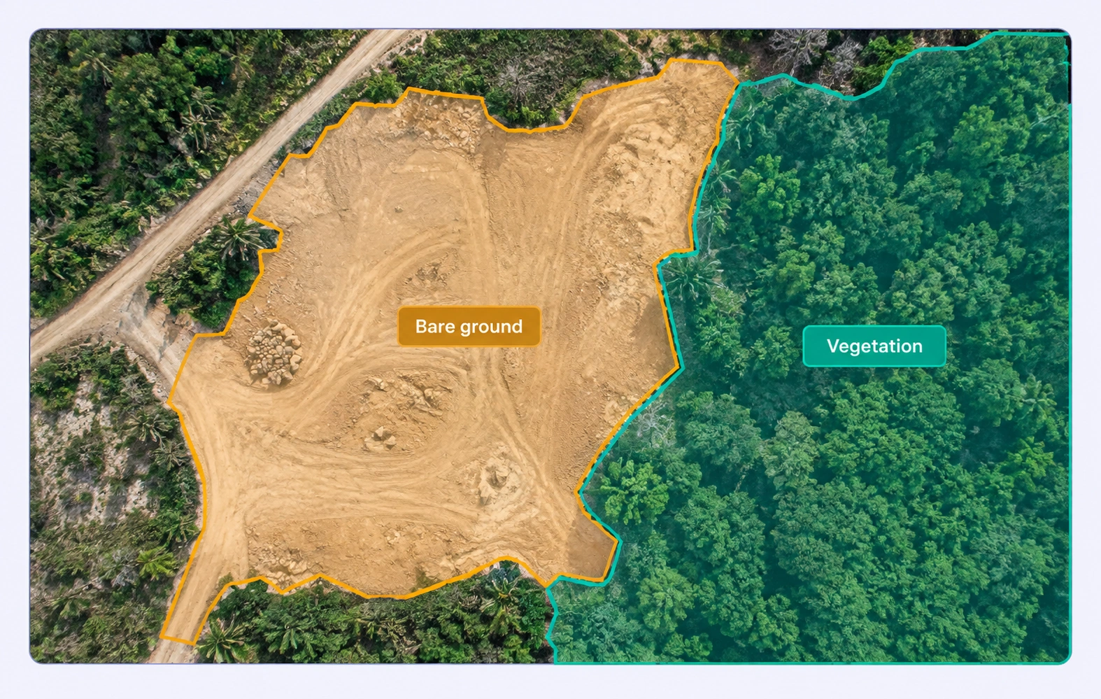
Aerial imagery with bare-ground and vegetation class regions.

Bare ground and mixed cover

Label bare soil and mixed-cover areas using explicit rules for boundary and class choices.

Why AI Teams Choose Unitlab

Bring geospatial annotation, shared ontologies, expert review, and dataset delivery into one workflow so your team can focus on useful training data.
15X
Faster Geospatial Annotation
60%
Free Up AI Engineers’ Time
5X
Lower AI Development Costs

Annotation types for land use classification

Represent mapped areas, linear infrastructure, and discrete features with annotation geometry suited to each target.
Aerial residential landscape for land-use and land-cover classification.

Region polygons and masks

Represent land-cover areas with labeled boundaries or segmentation regions in the raster’s original coordinate space.

Linear and point features

Use lines for roads and points for discrete targets when the mapping task requires those geometries.

Aerial highway interchange with roads and lanes marked for infrastructure mapping.

Land Use Classification FAQs

What is land-use and land-cover annotation?

It labels the areas and features in geospatial imagery so models can learn classes such as water, vegetation, buildings, roads, or other task-defined categories.

How do land use and land cover differ in labeling?

Land cover describes visible surface classes, while land use adds a purpose defined by the task. Your guidelines should clarify which evidence supports each label.

Can I use a custom map class taxonomy?

Yes. Define the classes and properties required by your dataset and apply them consistently across satellite or aerial scenes.

Can I annotate both areas and roads?

Yes. Use polygons or masks for areas and line annotations for roads or other linear features.

Can the editor handle large raster images?

The geospatial viewer uses tiled navigation to inspect large images at different zoom levels while retaining full-resolution annotation geometry.

How can teams handle mixed land-cover areas?

Define whether mixed areas receive a separate class or are divided into constituent regions. Use the same boundary rules across annotators and review difficult cases.

Which geospatial imagery formats are supported?

Unitlab supports GeoTIFF, Cloud Optimized GeoTIFF, JPEG 2000, ERDAS IMG, and NITF raster inputs. Tiled navigation helps teams inspect large satellite and aerial images.

How are geospatial labels reviewed?

Reviewers inspect mapped regions and boundaries in their source raster, add comments, and return corrections through the workflow. A shared ontology keeps the map classes and properties consistent.

Can I export labels with geographic coordinates?

Yes. GeoJSON supports geographic output for valid georeferenced rasters. COCO, YOLO, and Unitlab Unified Export Format serve other training needs while retaining the appropriate source geometry.