
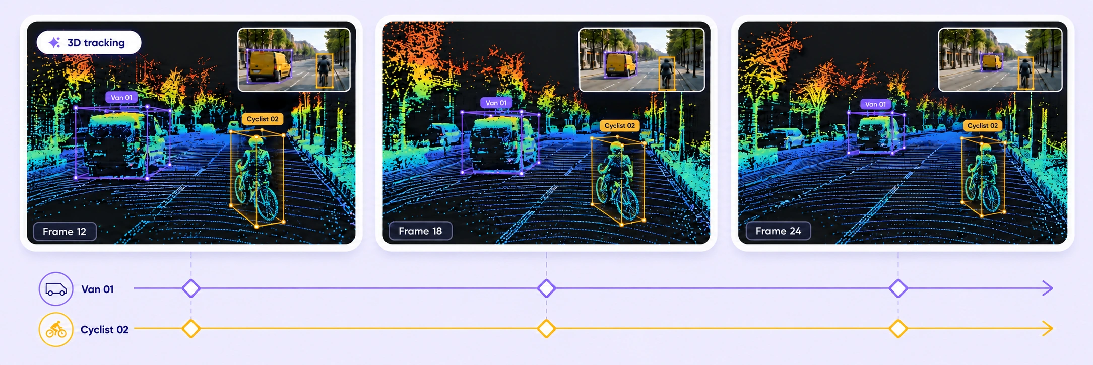
3D tracking
Combine LiDAR points and calibrated camera data with Find Similar and Auto-Tracking. Interpolate 3D cuboids between keyframes, then review and refine tracks in context.
Find SimilarAuto-Tracking3D interpolation

Build reliable 3D training data with point-cloud labeling, camera-assisted tracking, shared ontologies, and governed quality control.
Label 3D objects and point-level segments, connect calibrated sensor views, and refine tracks in one workspace.
Combine LiDAR points and calibrated camera data with Find Similar and Auto-Tracking. Interpolate 3D cuboids between keyframes, then review and refine tracks in context.
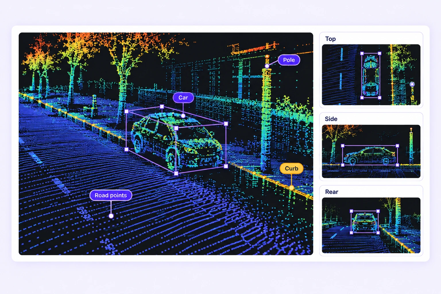
Fit cuboids in perspective and orthographic views. Paint point segments and label spatial boundaries with polygons, polylines, points, and spheres.
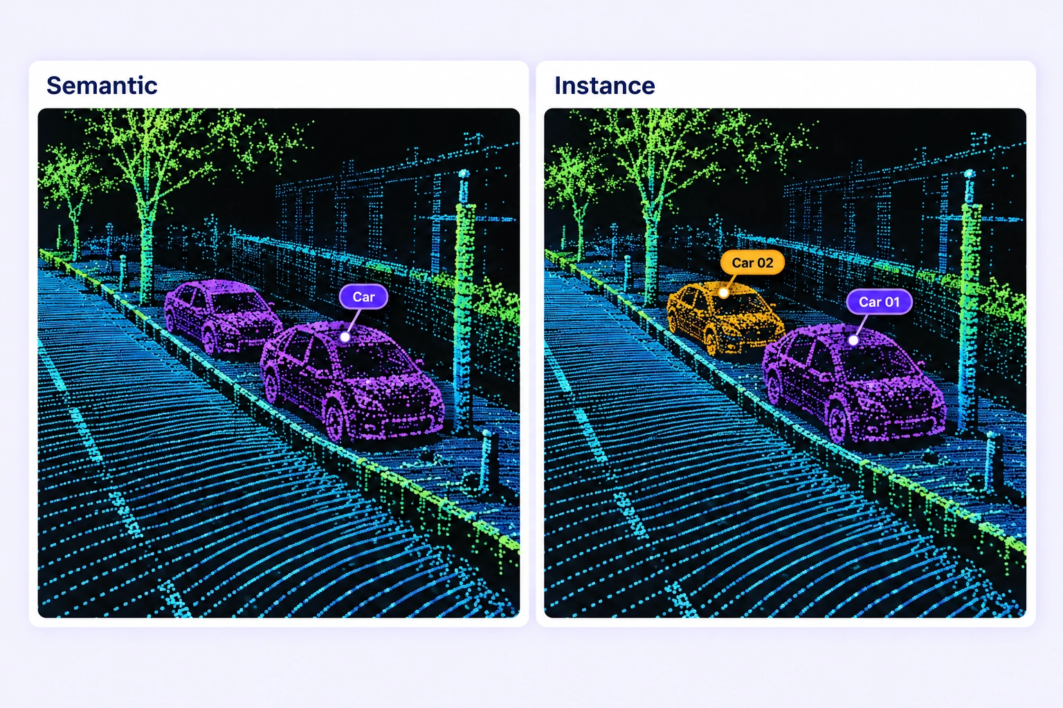
Label point clouds by semantic class and separate individual objects. Refine point-level labels in 3D with calibrated camera context.
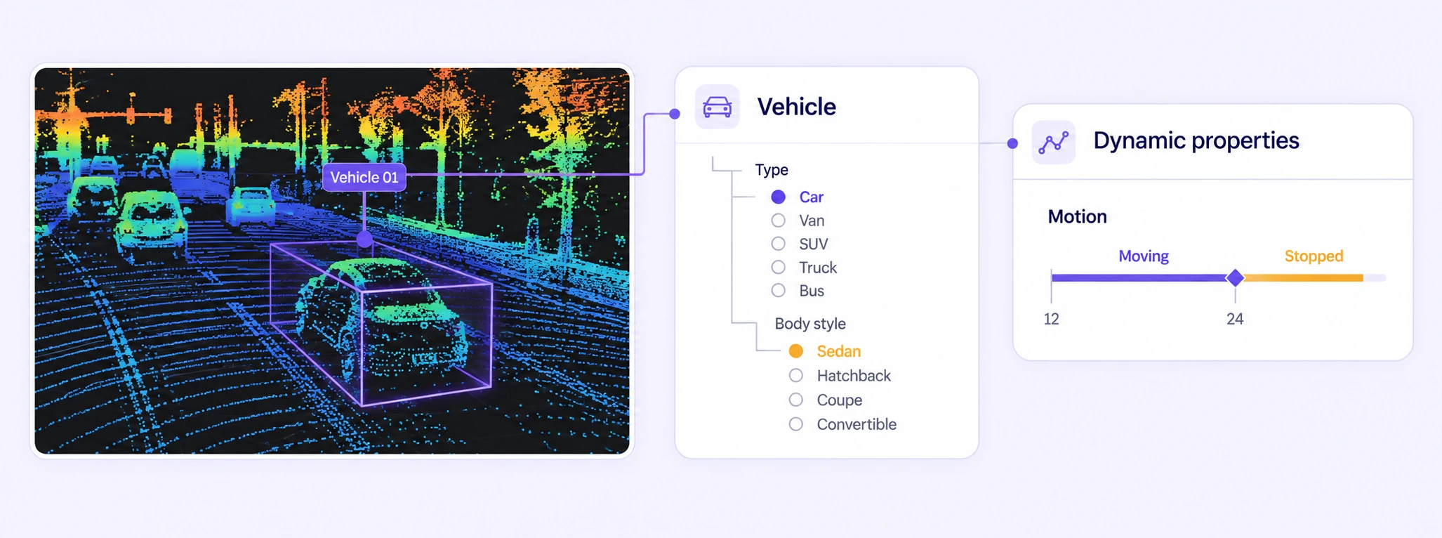
Define classes with nested, conditional properties for 3D objects and scenes. Record changing states by frame and inspect their temporal ranges on the timeline.
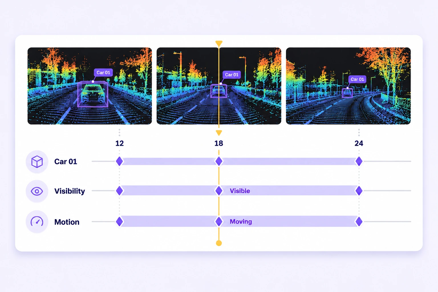
Review object tracks, visibility ranges, keyframes, and dynamic properties together. Navigate directly to the frame and object that need attention.
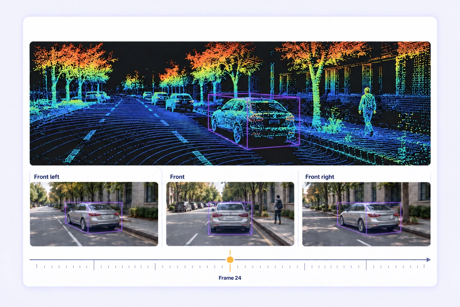
Inspect LiDAR and radar point clouds alongside synchronized camera images. Review projected 3D shapes and linked camera boxes with the original sensor context.
Annotate complex LiDAR datasets faster with AI-assisted automation, scalable workflows, and lower operational costs.
Batch workflows, camera-assisted Find Similar and Auto-Tracking, and interpolation reduce repetitive manual LiDAR labeling.
On average, 85% of LiDAR labels are pre-labeled automatically, then reviewed and refined by humans.
The cost per accepted label can be up to 15× lower as curation, annotation, and QA are automated.
Choose the geometry and properties your perception task needs, then apply them consistently across every scene.
Label objects with oriented 3D boxes, precise dimensions, and rotation. Refine their fit in perspective, top, side, and rear views.
Paint point-level object and scene labels. Assign classes and properties while retaining the original point-cloud context.
Outline spatial regions with 3D vertices and closed boundaries for consistent region annotation.
Mark spherical regions with an editable centre and radius. Maintain class properties and temporal states.
Trace curbs, barriers, and other open boundaries with connected 3D points.
Mark precise spatial locations and landmarks with class labels and structured properties.
Connect a 3D cuboid to its 2D box in a calibrated camera image and review both views together.
Apply reusable classifications and conditional attributes. Record frame-varying properties for objects and scenes.
Maintain stable object identities, visibility ranges, and editable keyframes across a point-cloud sequence.
Compare independent scene annotations, check labels against approved references, and resolve issues with the point cloud and frame context in view.
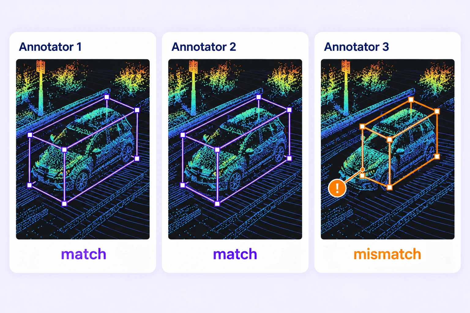
Compare independent annotations of the same LiDAR scene. Review disagreements in 3D geometry, classes, and object properties before approving labels.
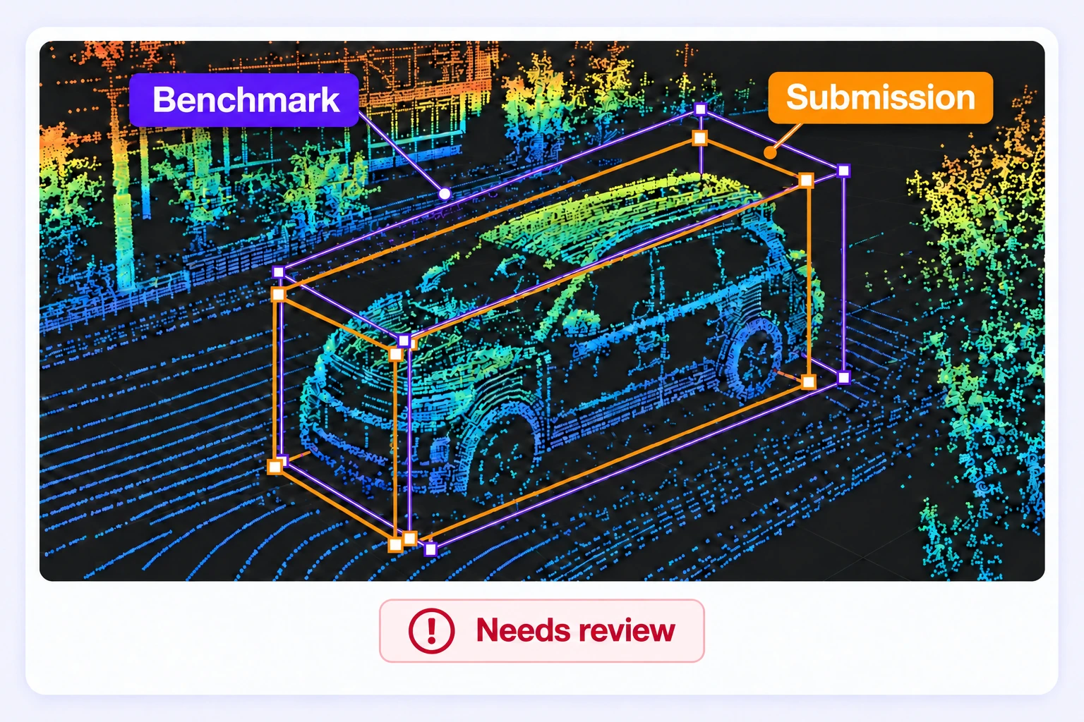
Check scene annotations against approved reference labels hidden from annotators. Route results through pass, fail, or not-evaluated paths using configured criteria.
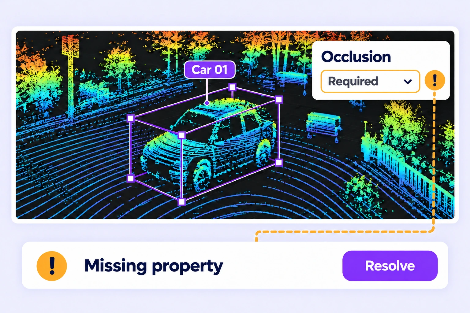
Find missing required properties and annotation issues. Assign corrections, inspect the affected object and frame, and resolve feedback before release.
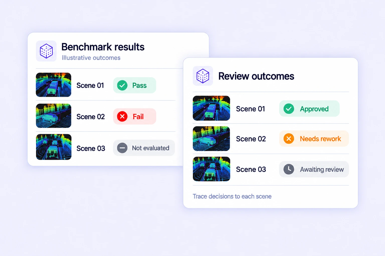
Review benchmark results, consensus outcomes, open issues, and validation findings. Focus review on the scenes and objects that need attention.
Search, version, and inspect LiDAR datasets, connect AI models, and move annotations through review and approval.
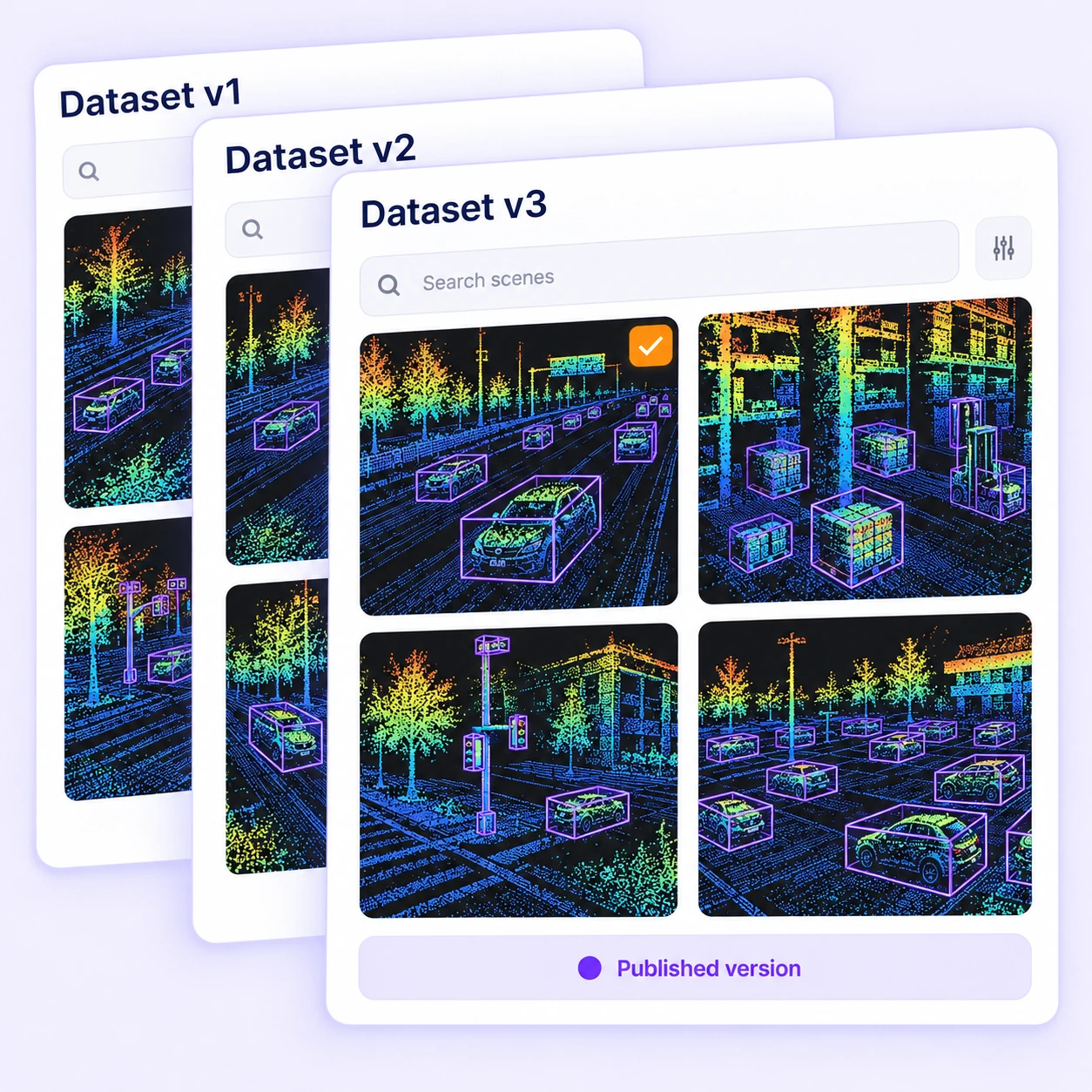
Create scene datasets, freeze selected versions, and attach them to projects without re-uploading. Keep data selection and releases traceable.
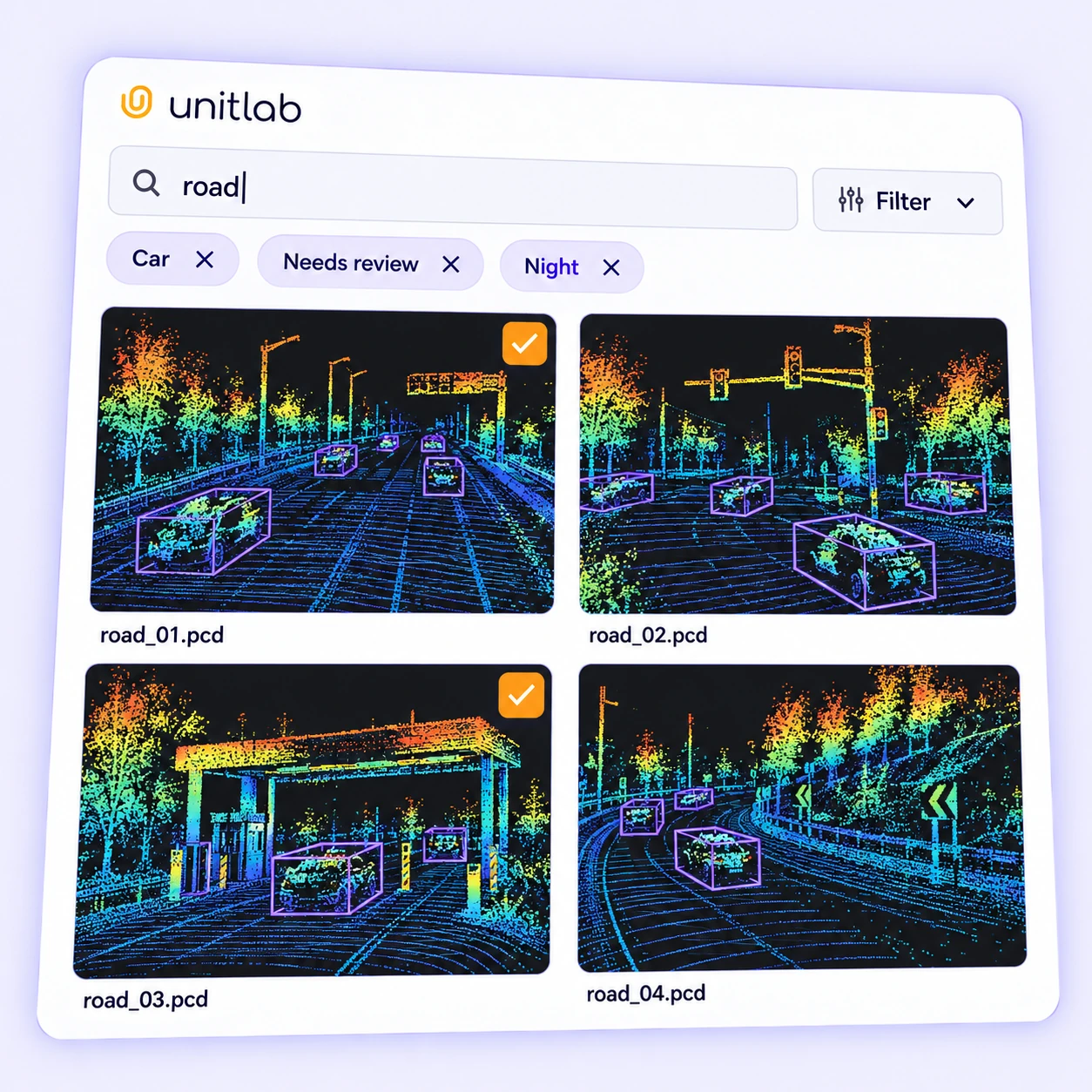
Find scenes by folders, tags, classes, properties, assignees, and issue status. Build focused annotation queues from the data you need.
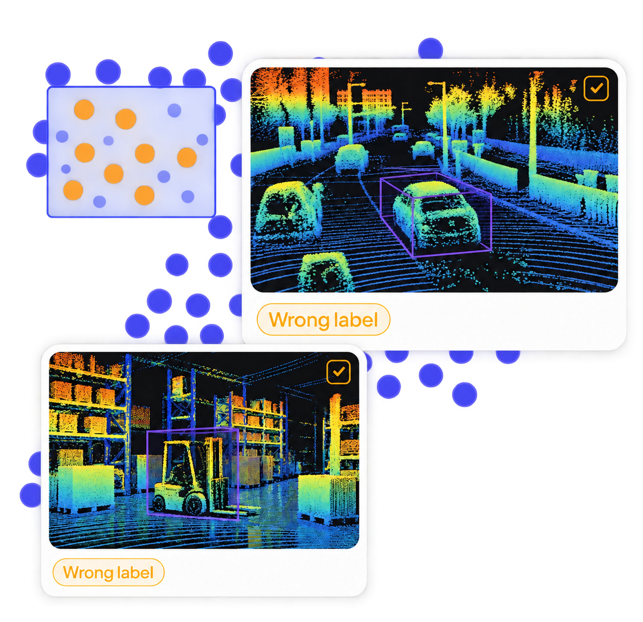
Visualize LiDAR datasets with your own embeddings to inspect clusters, outliers, and labeling issues before training.
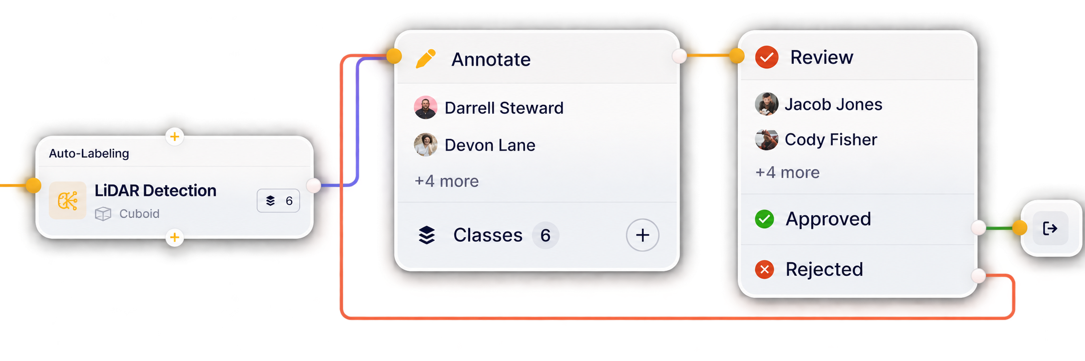
Build workflows that connect LiDAR annotation, review, and quality assurance in one continuous loop. Reduce handoffs and keep datasets moving from labeling to approval.
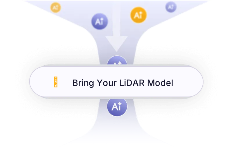
Prepare reviewed 3D labels and versioned datasets for your LiDAR model pipeline. Talk to our team about your model integration requirements.
Build reviewed 3D training data for autonomous driving, robotics, warehouse perception, and infrastructure mapping.
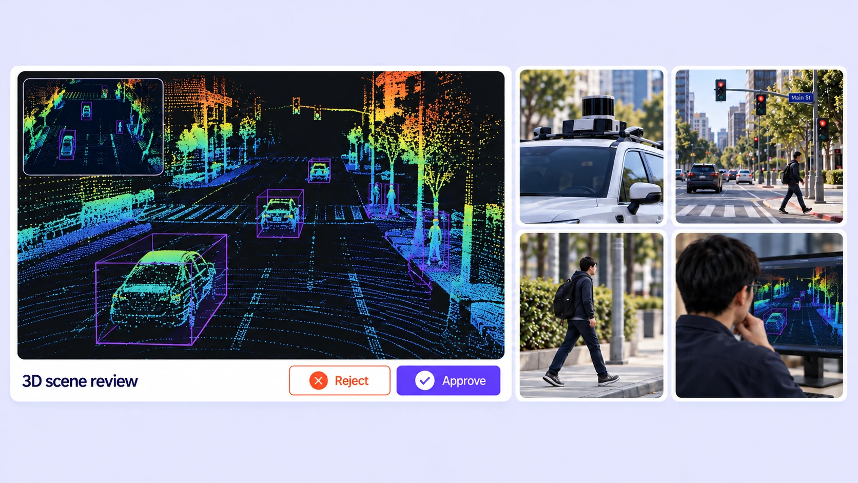
Label road users, point-cloud scenes, and temporal tracks with calibrated camera context.
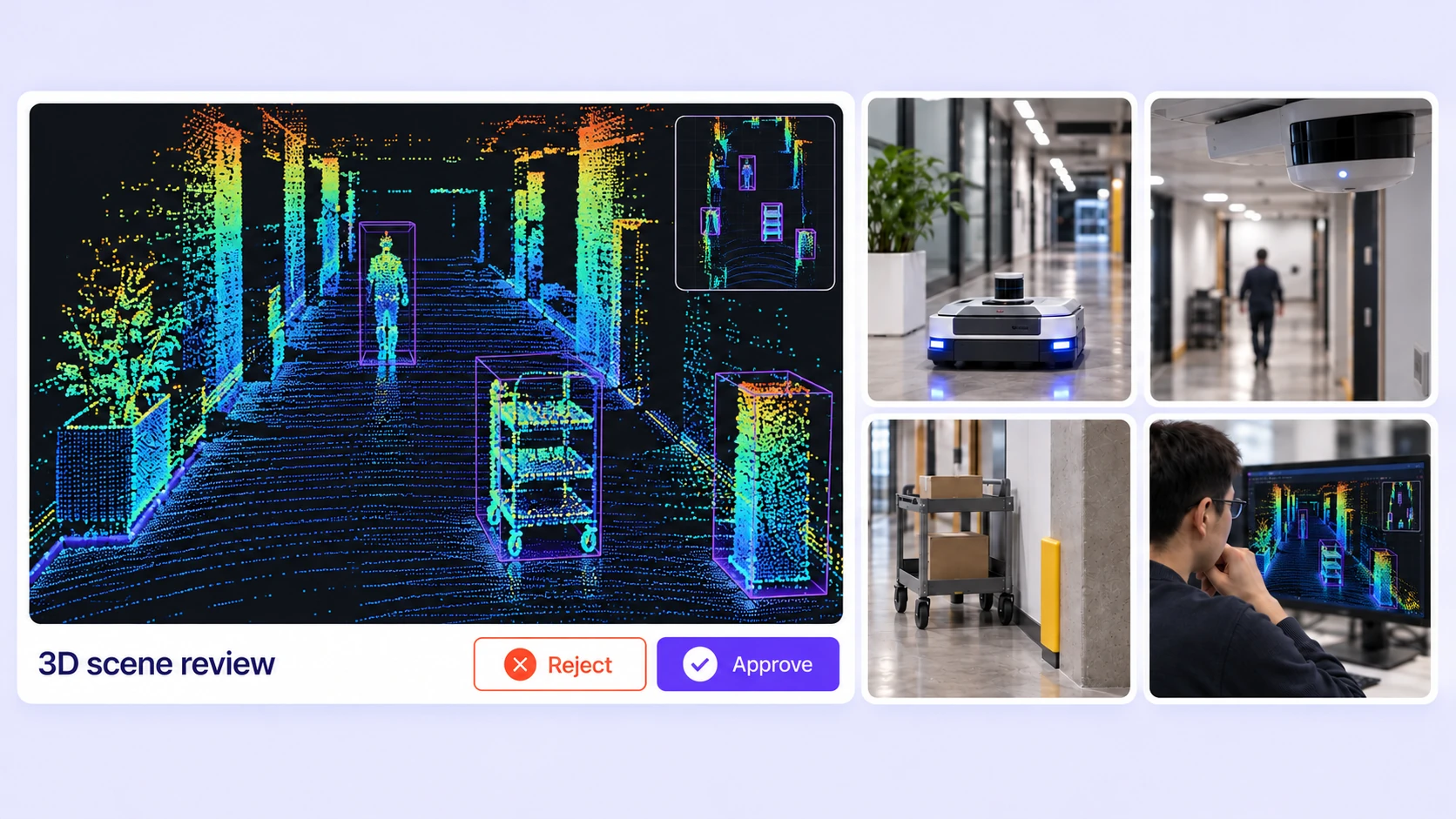
Annotate people, obstacles, and spatial boundaries for robot perception datasets.
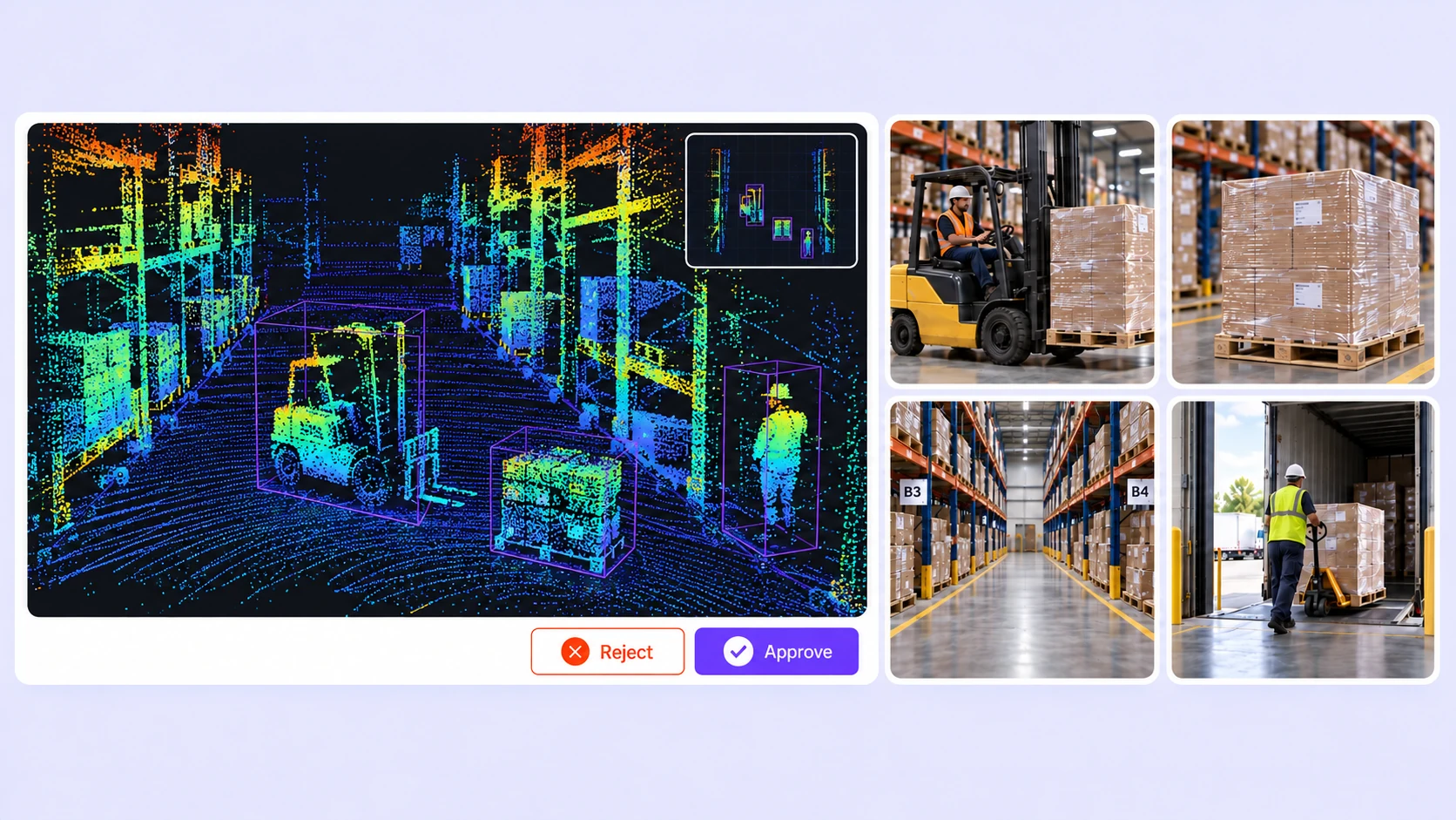
Label forklifts, pallets, racks, and indoor scenes with consistent 3D geometry and properties.
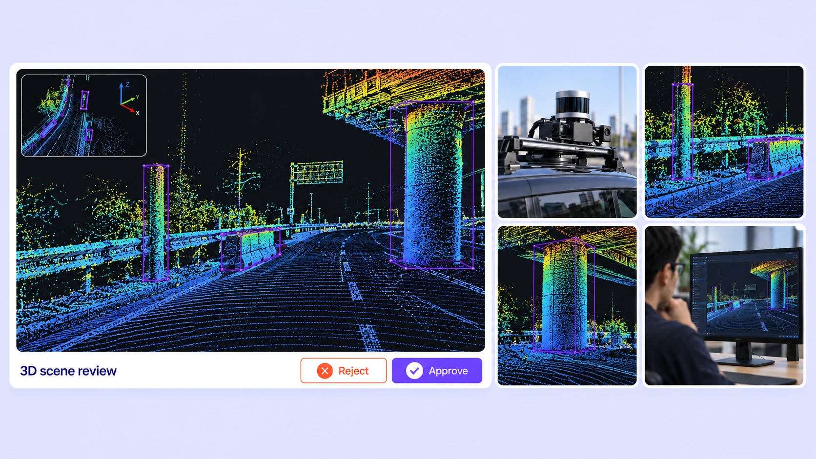
Annotate poles, barriers, structures, and corridor boundaries in point-cloud scans.
Answers about point-cloud formats, 3D labeling tools, calibrated camera views, tracking, quality assurance, and versioned datasets.
Talk with the Unitlab teamUpload PCD, PLY, and BIN point clouds as individual files, ZIP scenes, or folders. Scene manifests can include multiple LiDAR or radar sensors, calibrated cameras, and frame poses. Unitlab also converts supported nuScenes recordings into scene inputs.
Read LiDAR data preparationUnitlab supports oriented 3D cuboids, point segmentation, polylines, polygons, points, and spheres. Linked camera boxes connect to their 3D cuboids. Shared ontologies define classes, conditional properties, and scene-level labels.
Explore 3D annotation typesA scene keeps point clouds and camera images aligned by frame. Supplied calibration and sensor poses let annotators inspect projected 3D shapes, linked camera boxes, and point overlays in the original camera context.
Read camera calibration guideFind Similar uses a selected object in a calibrated camera image, then fits candidate cuboids to LiDAR points. Auto-Tracking follows camera evidence across frames and creates editable 3D keyframes while preserving manual corrections. Interpolation fills supported geometry between trusted keyframes, and batch view helps review cuboid drift.
Explore LiDAR tracking and interpolation Explore LiDAR Find SimilarYes. Define nested, conditional properties for objects and scenes, then set frame-varying values such as motion state or occlusion. The scene timeline displays object tracks, keyframes, visibility ranges, and property intervals together.
Explore dynamic propertiesConsensus compares independent annotations of a LiDAR scene and opens disagreements for review. Quality Gate checks submissions against hidden approved references. Required-property validation and annotation issues support correction before release. Reviewers can inspect the relevant geometry and frame context.
Read LiDAR quality assurance guideOrganize scenes with folders and tags, filter by labels and review status, and freeze dataset versions. Export UUEF releases containing 3D annotations, temporal tracks, scene metadata, calibration, and point-label arrays for downstream training-data pipelines.
Explore LiDAR annotation exportsBring point-cloud annotation, calibrated sensor context, quality assurance, and dataset operations into one governed workflow.


We use cookies to improve your experience. See our Privacy Policy and Cookie Policy.