
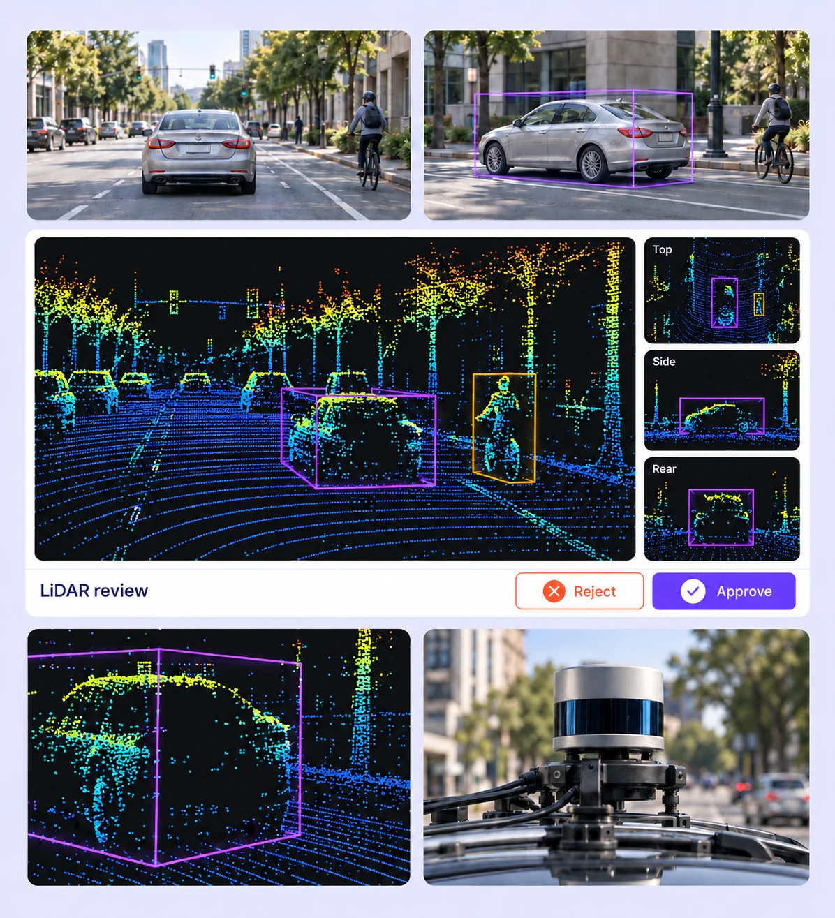
Batch workflows, camera-assisted Find Similar and Auto-Tracking, and interpolation reduce repetitive manual LiDAR labeling.
On average, 85% of LiDAR labels are pre-labeled automatically, then reviewed and refined by humans.
The cost per accepted label can be up to 15× lower as curation, annotation, and QA are automated.
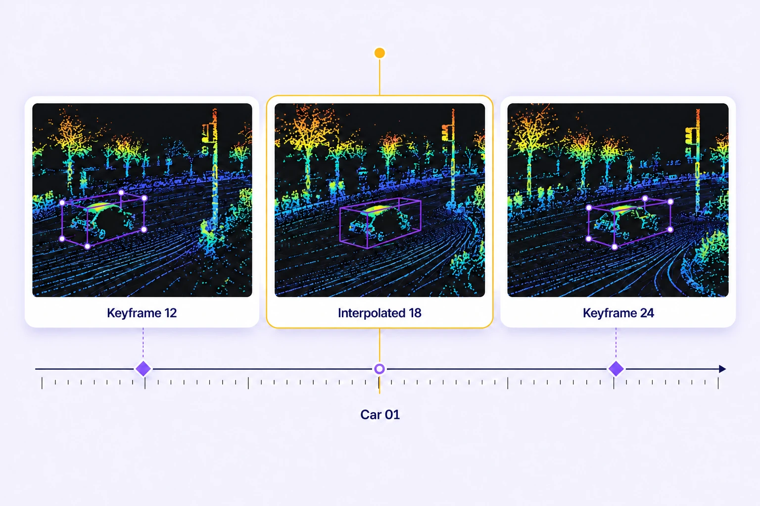
Check position, dimensions, orientation, and identity across scene frames. Use orthographic views and calibrated camera context to resolve loose boxes, drift, and visibility changes.
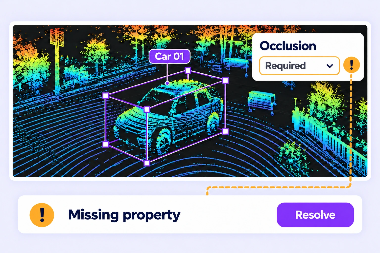
Inspect class assignments at object boundaries and sparse regions. Correct mislabeled points, missing required properties, and unresolved issues before release.
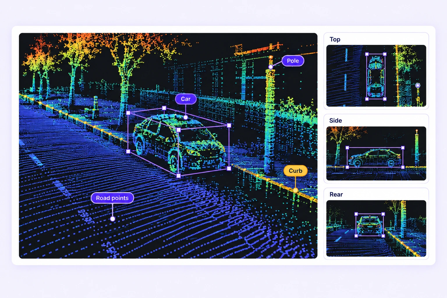
LiDAR annotation QA checks whether 3D geometry, point labels, object properties, and tracks follow the project specification. Unitlab connects the point-cloud scene, calibrated camera views, annotation comparisons, and human review. LiDAR QA overview
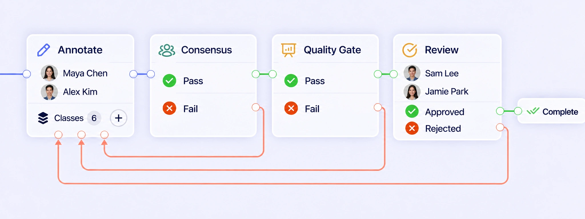
Configure annotation, Consensus, Quality Gate, and Review stages for the project. Reviewers inspect the scene, assign corrections, and return work for revision when labels need attention. Review the updated result before approval. QA workflows
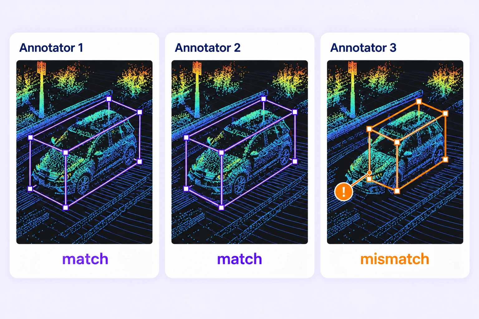
Consensus collects independent annotations of the same standalone LiDAR scene, compares supported geometry and properties, and opens disagreements for review. Reviewers approve the final result. Consensus for Data Groups containing LiDAR is not currently supported. Consensus guide
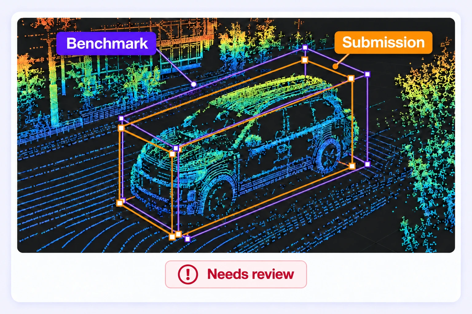
A Quality Gate compares submitted annotations with an approved reference key hidden from annotators. It evaluates labels across visible scene frames and applies the configured threshold. Comparisons with unreadable point-label data or incompatible scene data are marked not evaluated. Quality Gate guide
Oriented cuboids and spheres use volume overlap. Points, polylines, and polygons use spatial or path similarity, while point segmentation compares point labels. Polygon comparison measures boundary agreement rather than filled-surface overlap. Linked camera boxes follow their 3D cuboid. 3D annotation comparisons
Define whether labels describe observed or inferred object extent, then apply that rule consistently. Inspect adjacent frames, orthographic views, and available calibrated camera images. Send uncertain cases for review and record the relevant visibility properties. Calibrated camera views
Review the assigned point labels in their original scene and correct the affected regions. Consensus review starts from one submitted point-label array for refinement; it does not automatically fuse painted labels from multiple annotators. Point-label review
Yes. Review missing required properties, assigned issues, benchmark scores, and pass rates. Use these results to focus review effort on scenes that need attention, then check the corrections before preparing a release. Review stages
Create a reviewed annotation release and export LiDAR results in Unitlab Unified Export Format, or UUEF. The export preserves supported 3D geometry, tracks, scene metadata, sensor calibration, and point-label arrays. Validate the result against your downstream training pipeline. LiDAR export guide


We use cookies to improve your experience. See our Privacy Policy and Cookie Policy.