LiDAR Training Data for Robotics Perception

Annotate obstacles, people, objects, and workspace structure in 3D scenes. Build reviewed examples for robotics perception with shared ontologies and calibrated sensor context.
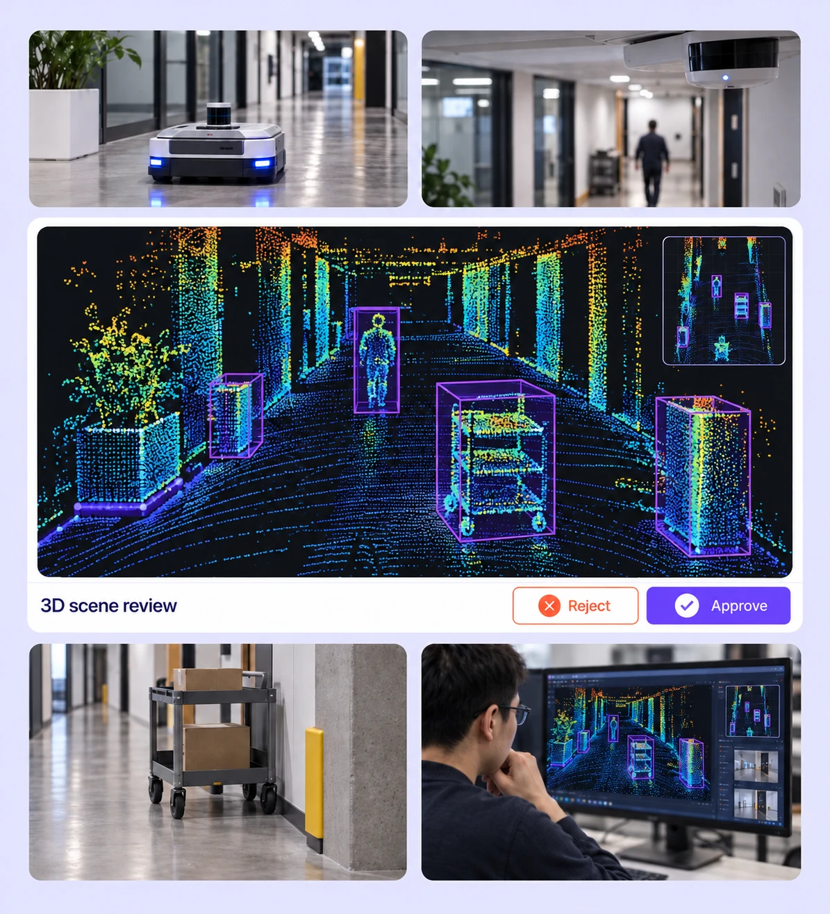
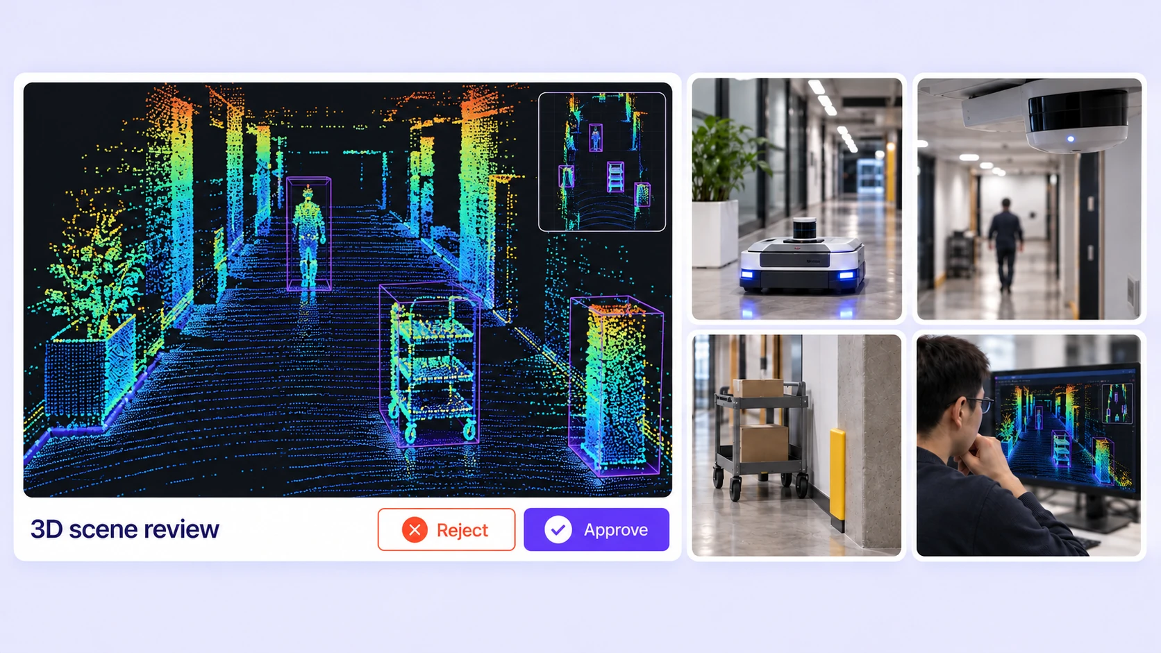
Indoor LiDAR scan with height-colored point returns and cuboids for people, carts, and obstacles.

LiDAR Annotation for Robotics Perception

Prepare labels for obstacles, workspace regions, and moving objects across robot recordings.
Indoor LiDAR scan with height-colored point returns and cuboids for people, carts, and obstacles.

Obstacle and Object Cuboids

Define oriented 3D extents for carts, equipment, and obstacles. Refine dimensions and rotation against the measured points.
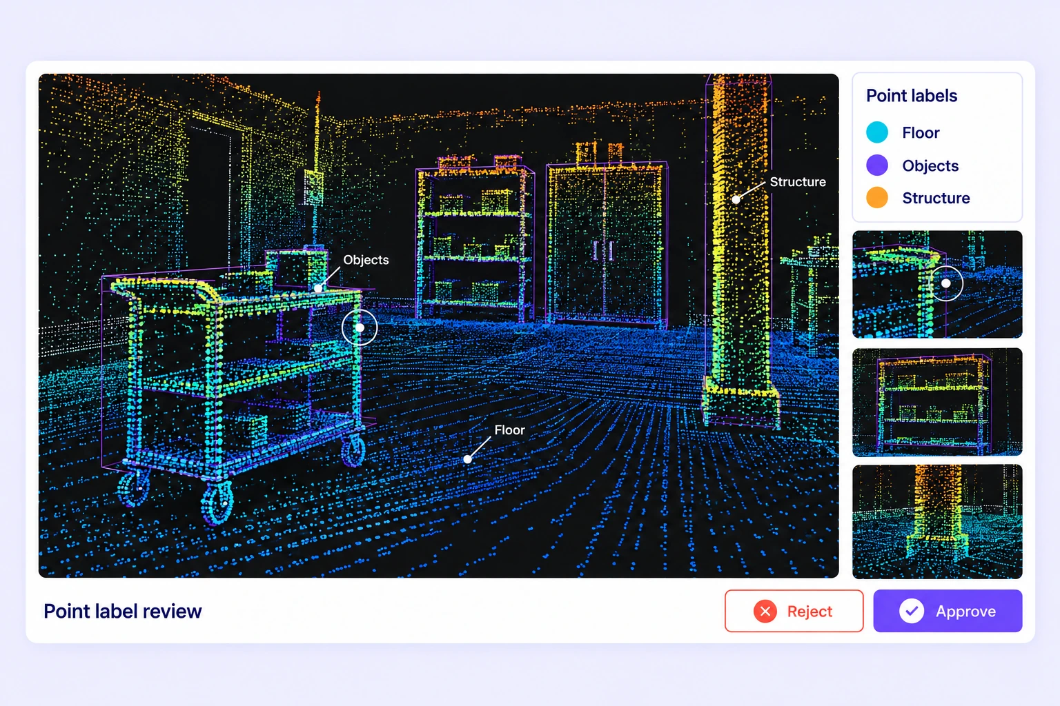
Workshop point cloud with floor, objects, and structural points labeled in distinct classes.

Workspace Point Segmentation

Label task-relevant point classes for floors, structures, and objects. Inspect boundaries where adjacent surfaces or sparse measurements create ambiguity.
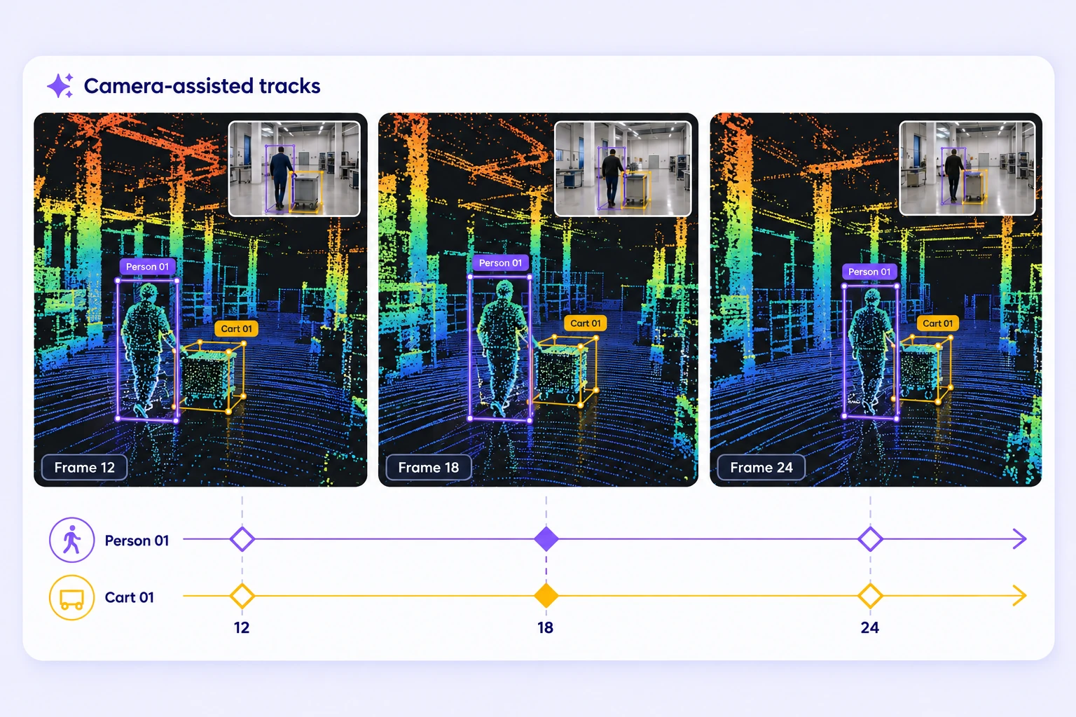
An indoor hall height-colored LiDAR sequence follows a person and a wheeled cart with matching camera insets and consistent cuboid tracks across three frames.

Moving Objects Across Frames

Keep consistent track identities for moving people and objects. Refine keyframes and visibility ranges as the scene changes.
An indoor hall height-colored LiDAR sequence follows a person and a wheeled cart with matching camera insets and consistent cuboid tracks across three frames.

Calibrated Sensor Context

Review point-cloud labels with synchronized camera images. Use multiple perspectives to resolve object classes and partial occlusion.

Built for AI Data at Scale

Annotate complex LiDAR datasets faster with AI-assisted automation, scalable workflows, and lower operational costs.
15×
Faster LiDAR data annotation

Batch workflows, camera-assisted Find Similar and Auto-Tracking, and interpolation reduce repetitive manual LiDAR labeling.

85%
Automated LiDAR annotation

On average, 85% of LiDAR labels are pre-labeled automatically, then reviewed and refined by humans.

15×
Lower Training Data Costs

The cost per accepted label can be up to 15× lower as curation, annotation, and QA are automated.

Annotation Methods for Robotics Perception

Use object geometry, point labels, and changing scene properties to describe a robot’s surroundings.
Workshop point cloud with floor, objects, and structural points labeled in distinct classes.

Spatial Labels for Perception Tasks

Choose cuboids, points, polylines, polygons, spheres, or point segmentation according to the model output. Keep class definitions and required properties consistent across recordings.

Scene Timelines and Dynamic Properties

Review object tracks and changing properties over the recording. Correct geometry and state changes at the frames where the source evidence supports them.

An indoor hall height-colored LiDAR sequence follows a person and a wheeled cart with matching camera insets and consistent cuboid tracks across three frames.

Robotics LiDAR Annotation FAQs

What is LiDAR annotation for robotics?

It is the preparation of labeled point-cloud examples for robotics perception models. Labels describe objects, obstacles, workspace regions, and their changes across recorded scenes.

Can I label both objects and scene surfaces?

Yes. Use cuboids and other spatial shapes for object geometry, or point segmentation for class-labeled point regions. Define the label boundaries and expected model output before selecting a tool.

Can I combine LiDAR and camera context?

Yes. A scene can contain point-cloud sensors and camera images with calibration and poses. Annotators can inspect multiple views while keeping annotations tied to the recorded 3D scene.

Can I track people or moving obstacles?

Use persistent 3D object tracks, keyframes, interpolation, and visibility ranges. Camera-guided cuboid tracking is available when a suitable calibrated camera sequence is present; generated results still need review.

How do I keep labels consistent across robot recordings?

Define reusable classes, nested properties, and clear boundary and visibility rules. Use representative examples, required-property checks, and contextual review to resolve differences across recording sessions.

How does Find Similar help label repeated objects?

Select a cuboid and use Find Similar in a calibrated camera view to find similar objects. Fit candidate detections to the LiDAR points, review their classes and geometry, and accept the labels you need.

Which point-cloud inputs can I upload?

Upload supported PCD, PLY, and BIN point clouds through file, ZIP scene, or folder workflows. Use a scene manifest for frame sequences, sensor definitions, camera calibration, and poses where required.

How can I review robotics annotations before training?

Combine expert review with standalone-scene Consensus and approved Quality Gate benchmarks. Inspect geometry and properties in context, assign issues, and review corrections before creating an annotation release.

How do I export the reviewed dataset?

Export LiDAR annotations in Unitlab Unified Export Format (UUEF) with supported 3D geometry, tracks, scene metadata, calibration, and point-label arrays. Validate the exported labels against the coordinate and class conventions expected by your training pipeline.