

Model-assisted labeling and shared review streamline satellite and aerial annotation.
Automate curation, management, and versioning of geospatial datasets.
Reusable ontologies and governed quality control reduce labeling and review rework.
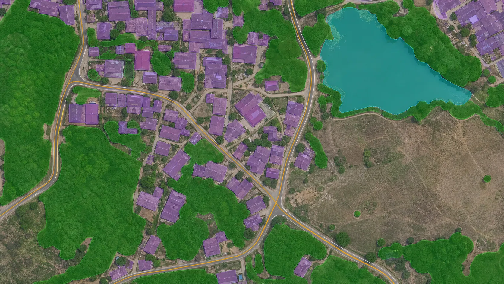
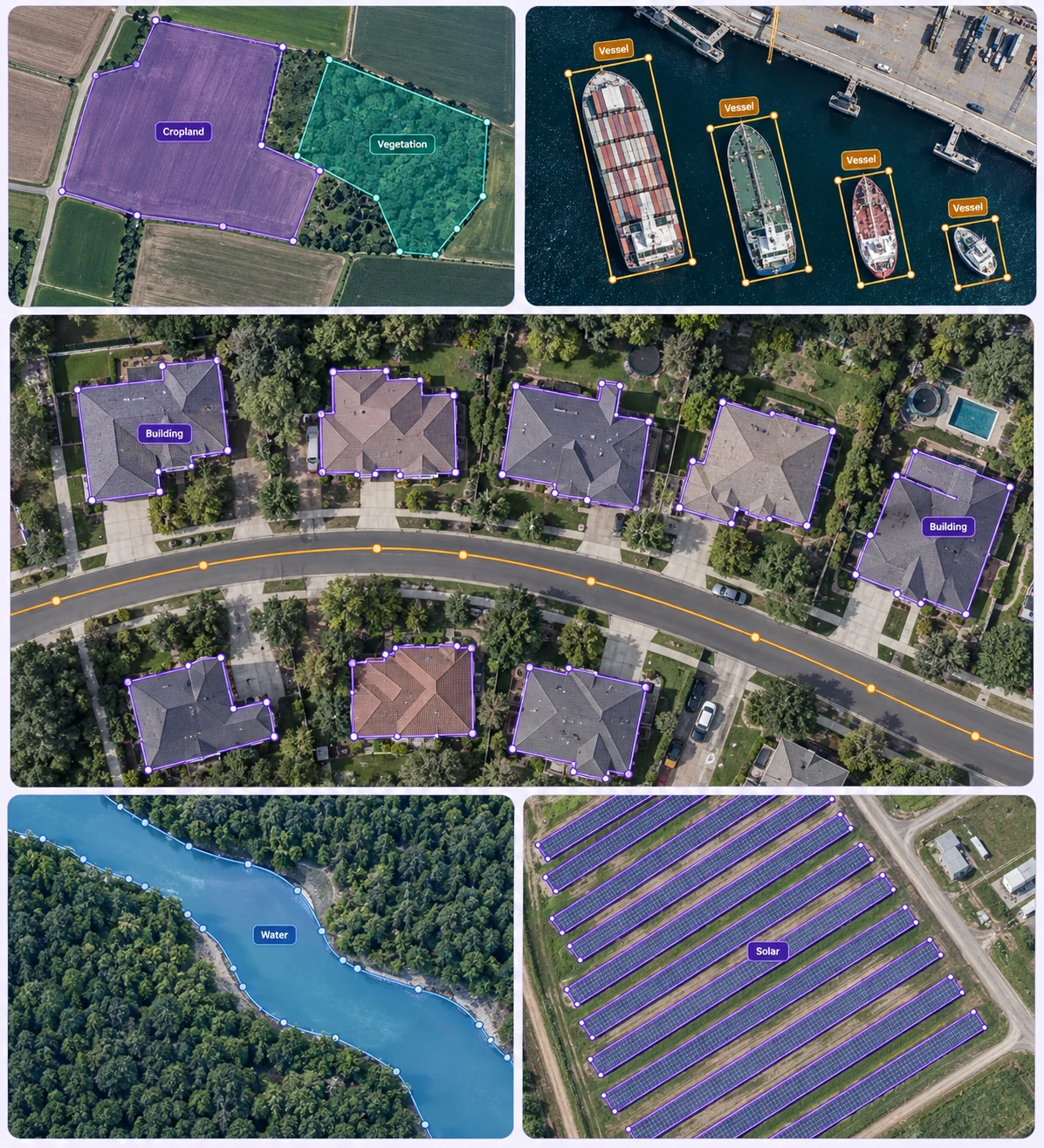
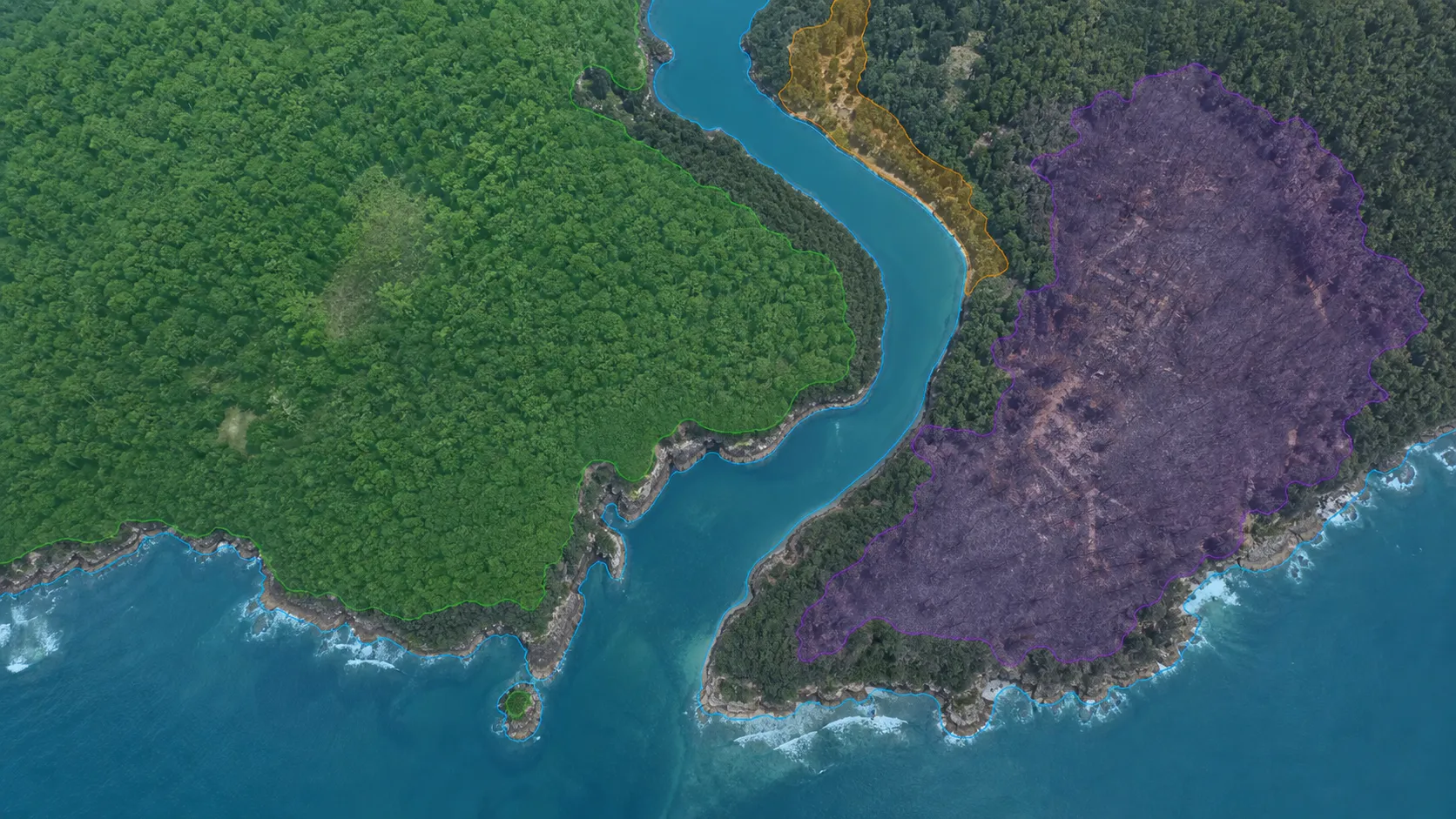
Use region masks to distinguish buildings, water, vegetation, and other land-cover classes in the original image context.
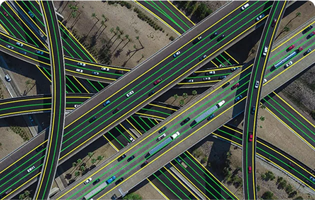
Trace linear features with polylines and outline geographic regions with polygons under a shared annotation protocol.
Remote sensing collects information about the Earth from a distance, typically through satellite or aircraft sensors. For AI, teams turn these observations into labeled training examples for land cover, agriculture, infrastructure, and environmental monitoring using geospatial data annotation.
It adds labels to satellite and aerial imagery so models can learn to recognize objects and geographic regions. Examples include building polygons, road polylines, land-cover masks, and object boxes. Unitlab’s geospatial annotation tools support these labeling workflows within its data annotation platform.
Remote sensing describes how observations are collected and used, such as monitoring crops or mapping land cover. Geospatial data annotation is the labeling process that prepares imagery for AI. This solution page covers the remote sensing workflow; the geospatial annotation page explains the tools and supported labeling tasks.
Teams can prepare satellite and aerial imagery with geospatial annotation, navigating large images from scene context to detail. The Drones & UAVs solution covers drone-specific use cases. Check the geospatial documentation for input and workflow requirements.
Use polygons and segmentation masks for areas, polylines for roads and other linear features, and boxes for object instances. Define shared classes and boundary rules for consistent labels. Explore geospatial annotation capabilities and the tool documentation.
Inspect and filter available imagery before annotation, considering regions, acquisition dates, seasons, and capture conditions in your metadata. Data curation helps teams select relevant examples and identify gaps in dataset coverage before investing in labeling.
Reviewers inspect boundaries in the original image context and resolve uncertain classes against shared guidelines. Annotation quality assurance supports review stages, consensus, and quality gates where appropriate. See geospatial annotation QA for the geographic labeling workflow.
Yes. Use dataset management to visually inspect annotated examples, filter the data you need, and preserve dataset versions for traceable training inputs. Keep source-data selection and reviewed annotations connected as your dataset evolves.
Start with the geospatial annotation documentation for tools and workflows. For integrations, see the API, SDK, and CLI developer overview. Choose a supported export format that matches your annotation task and downstream training pipeline.


We use cookies to improve your experience. See our Privacy Policy and Cookie Policy.