
Built-in auto-labeling tools and automated workflows reduce manual annotation work.
Automate curation, dataset management, and versioning so engineers can focus on models.
Curated data, reusable ontologies, and quality control reduce annotation rework.
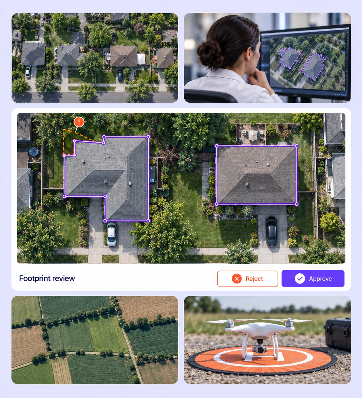
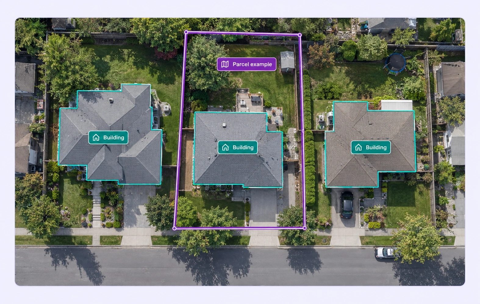
Check whether each in-scope roof or building region is present and its polygon follows the project’s boundary convention. Correct corners extending into lawns, roads, or shadows.
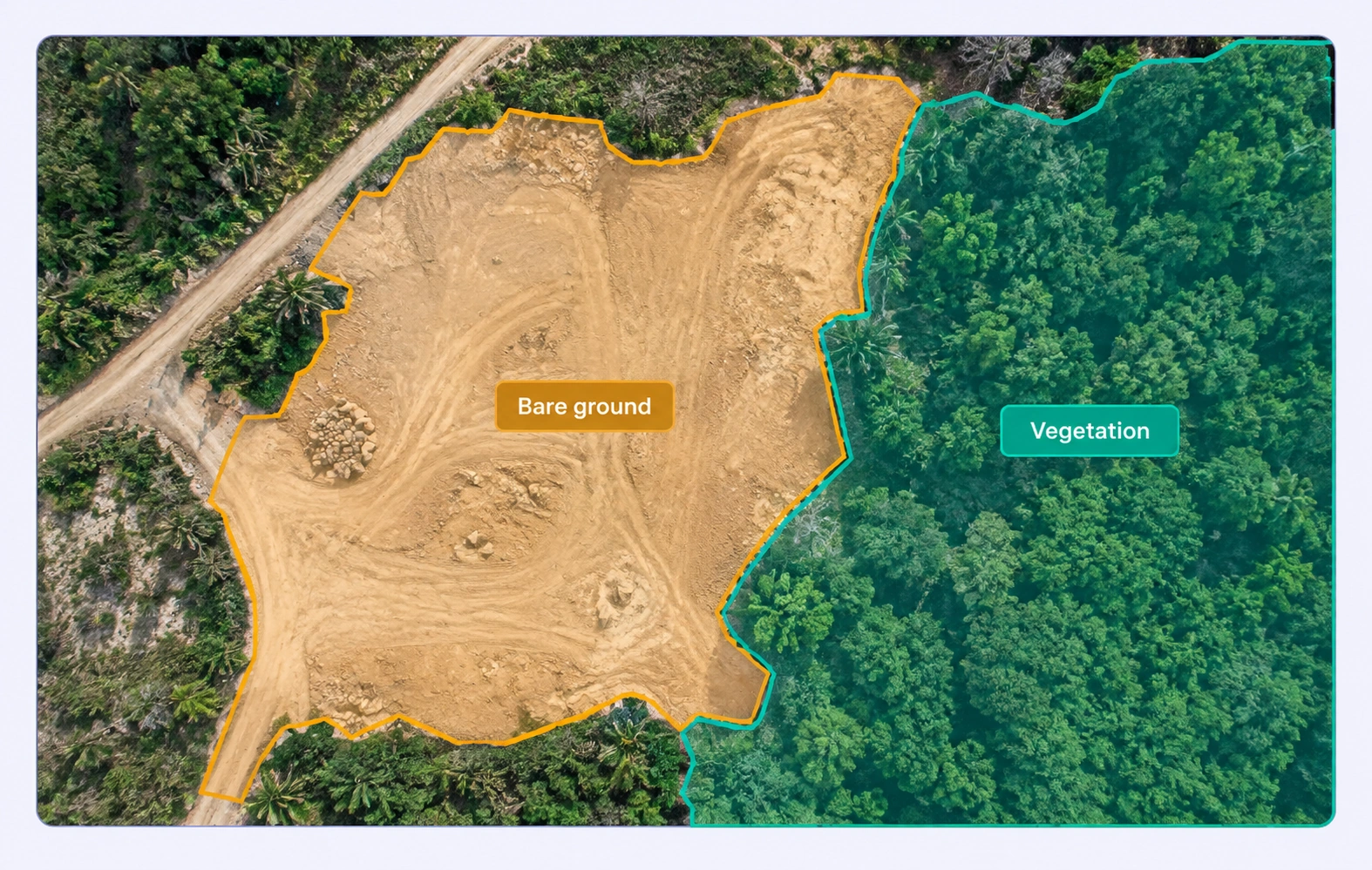
Review vegetation, bare ground, and other defined land-cover regions in their aerial context. Resolve ambiguous transitions and maintain consistent class rules across tiles.
It is the review of labels on satellite, aerial, and other supported geospatial imagery for completeness, class consistency, and geometric fit. Unitlab connects these checks to source imagery and a configurable review workflow. QA overview
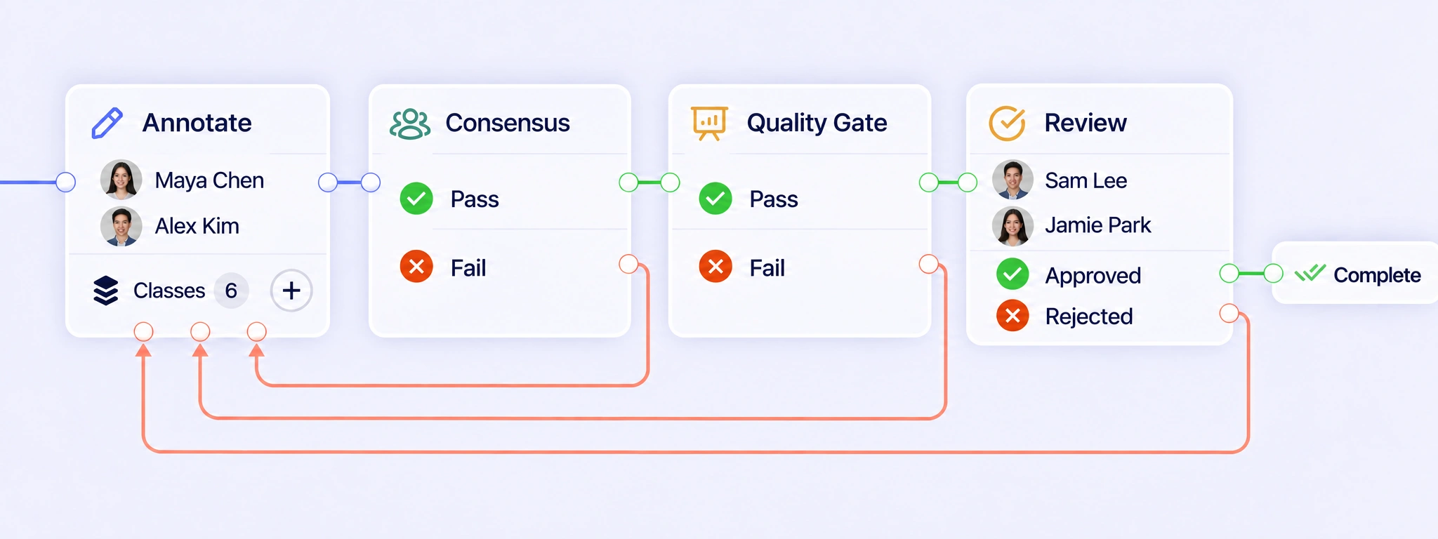
Configure annotation, Consensus, Quality Gate, review, and completion around the mapping task. Failed checks or rejected labels can return to annotation through a rework path. Review corrected polygons, masks, or other supported labels against the source imagery before the item continues through the required checks. QA workflows
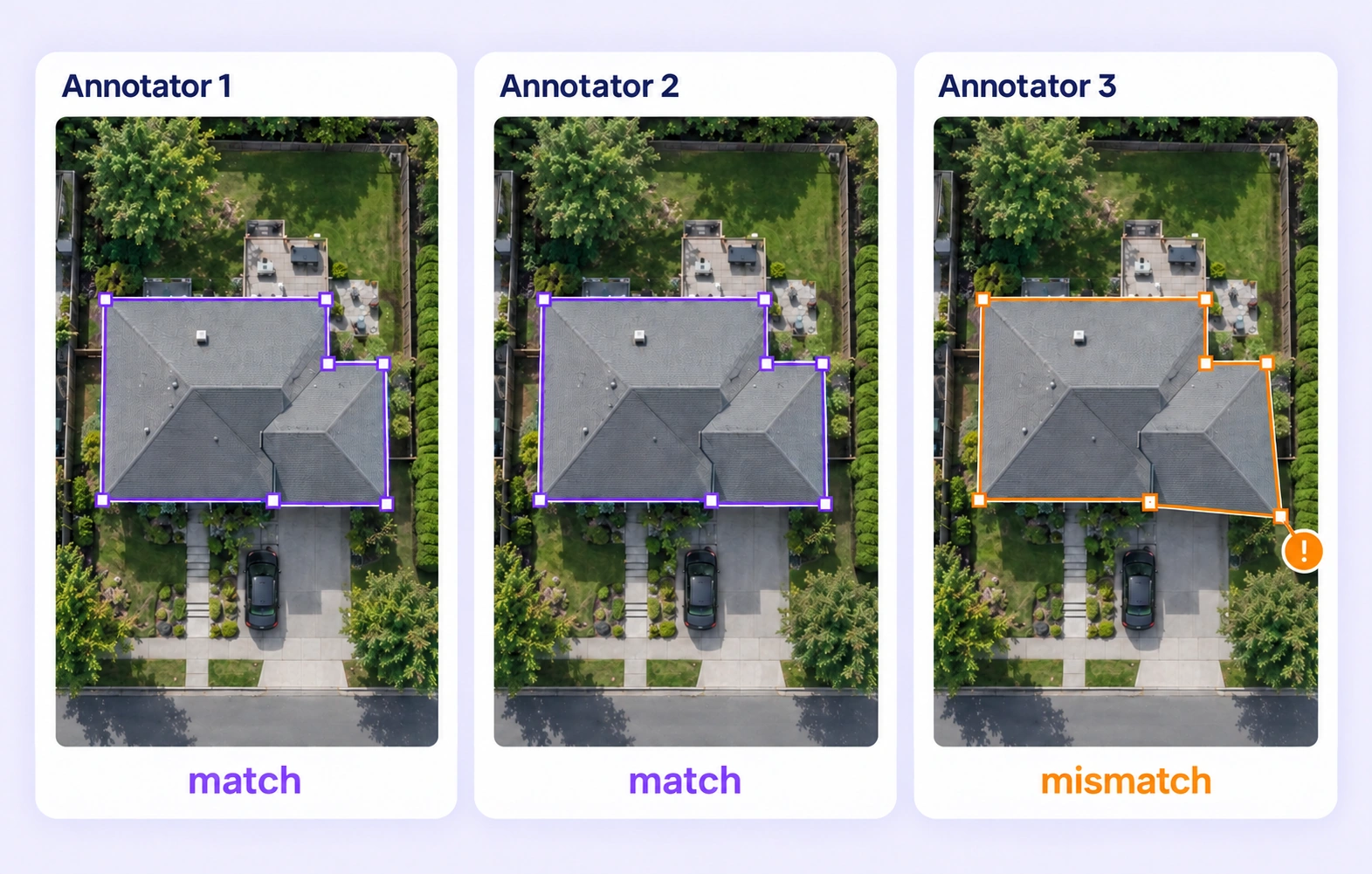
Consensus compares independent annotations of the same geospatial input under the configured settings. Reviewers can inspect missing structures, class disagreements, and shifted boundaries in the original image context. Agreement shows consistency between submissions; the mapping guidelines and expert review determine the intended final label. Consensus guide
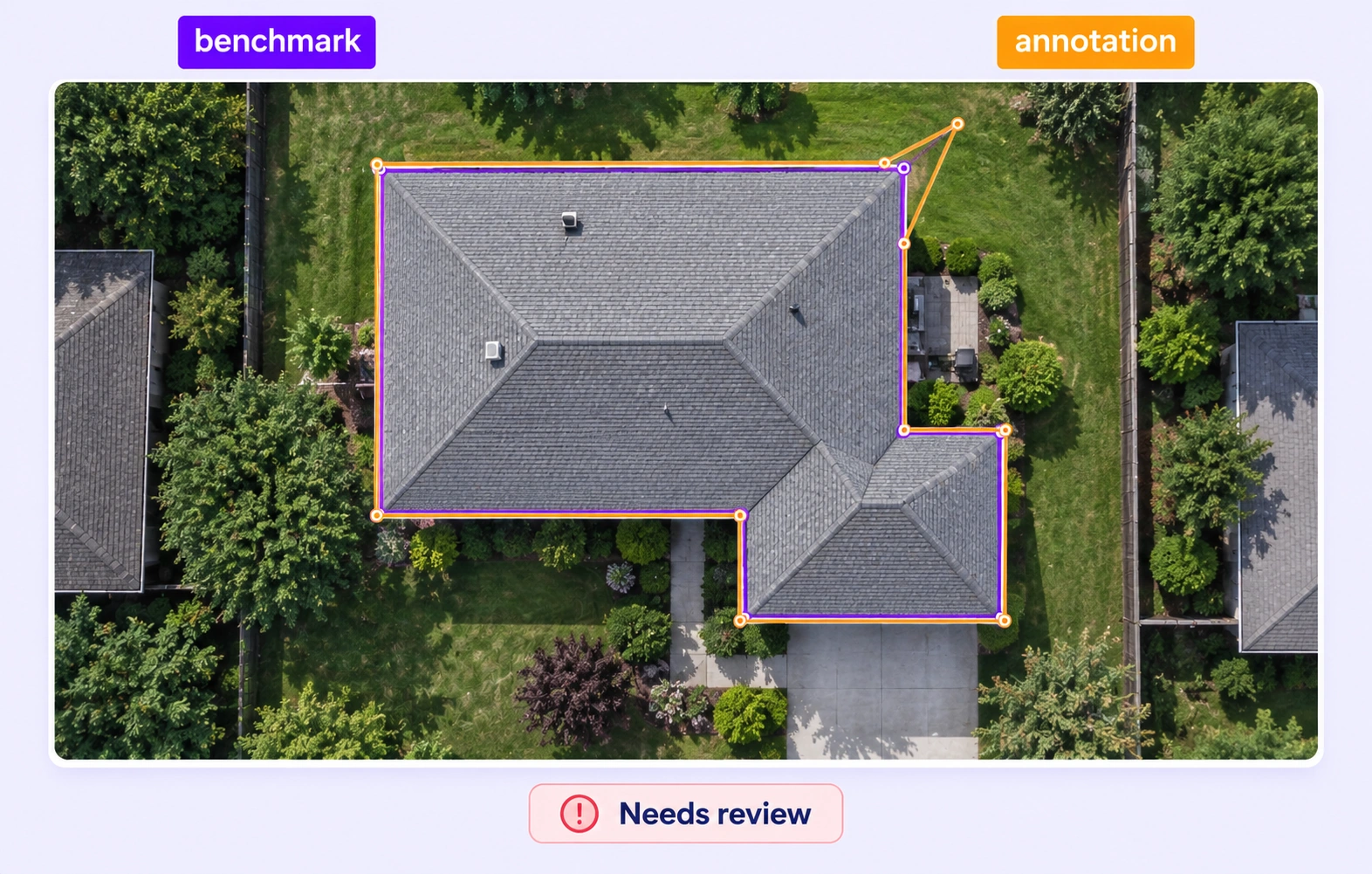
Quality Gate compares eligible submissions with an approved, frozen reference for the same geospatial item. The key stays hidden from annotators and represents the task’s accepted geometry and class conventions. Configure Pass, Fail, and Not evaluated separately so missing or incompatible comparison data receives appropriate review. Quality Gate guide
Define that convention before annotation begins. A visible roof outline and a ground footprint can differ, particularly in oblique imagery. Reviewers should apply the project’s chosen boundary rule consistently, checking roof corners, neighboring structures, and any permitted inference against the available source evidence. Review stages
Use clear definitions and examples for neighboring classes such as vegetation, built surfaces, and water. Review polygon or mask boundaries together with the assigned class and relevant properties. Inspect mixed or transitional areas in context, then resolve recurring ambiguities in the project guidelines. Review stages
Specify whether uncertain areas should be labeled from visible evidence, assigned an allowed uncertainty property, or handled through another defined review rule. Reviewers can inspect the surrounding imagery and apply that convention consistently. Avoid inventing a structure boundary where the task does not permit inference. Review stages
No. Annotation comparisons check supported labels against submissions or a chosen reference on compatible source coordinates. They do not certify the imagery’s positional accuracy or survey interpretation. Reviewers should assess annotation fit in image context while source georeferencing and mapping accuracy receive their own appropriate validation. Review stages
Create a reviewed dataset release and select an export supported by the geospatial input and annotation geometry. Confirm that class definitions, building-boundary conventions, and required properties match the downstream task. Keep the labeling guidelines and source context available to the team using the released data. Export documentation


We use cookies to improve your experience. See our Privacy Policy and Cookie Policy.