

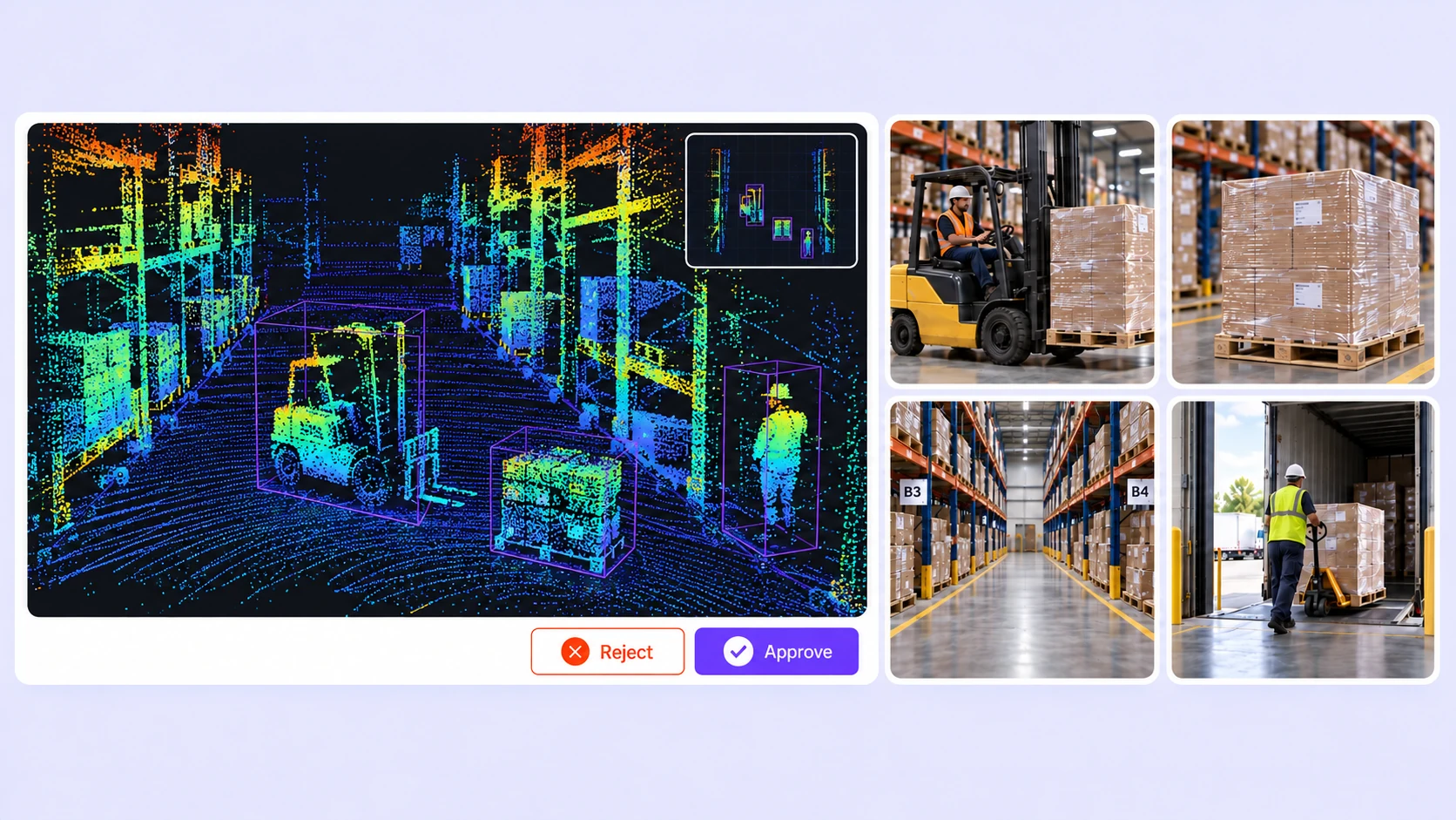

Batch workflows, camera-assisted Find Similar and Auto-Tracking, and interpolation reduce repetitive manual LiDAR labeling.
On average, 85% of LiDAR labels are pre-labeled automatically, then reviewed and refined by humans.
The cost per accepted label can be up to 15× lower as curation, annotation, and QA are automated.
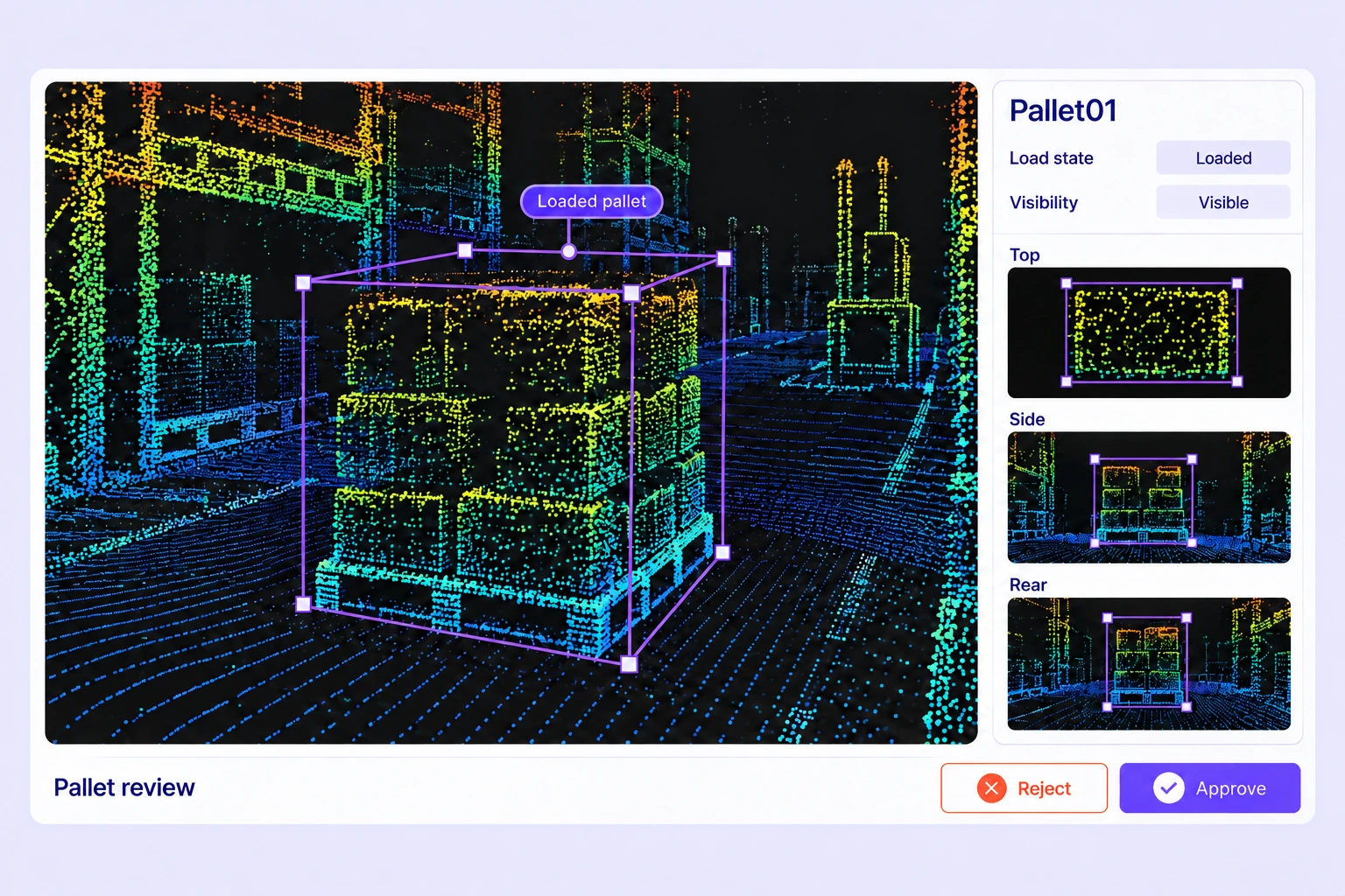
Inspect dimensions and orientation with orthographic views. Attach required properties such as object type or load state to keep geometry and task context together.
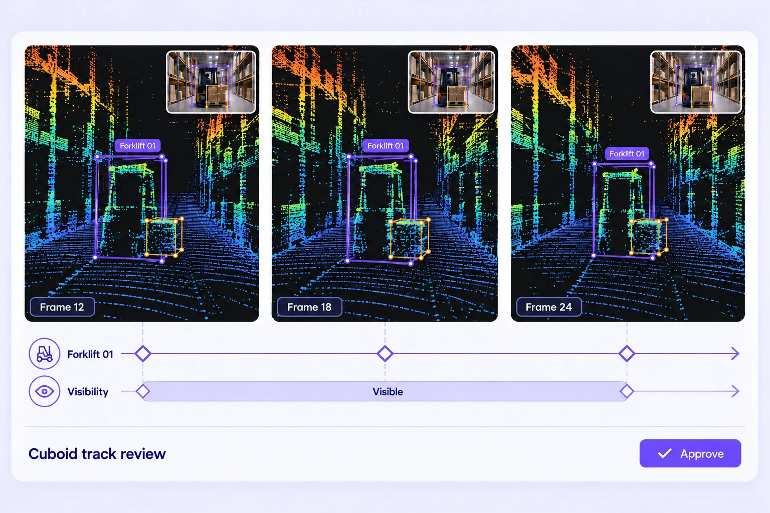
Use explicit keyframes and visibility ranges around racks, loads, and moving equipment. Inspect neighboring frames before approving an identity or geometry change.
It is the labeling of recorded warehouse point clouds for logistics perception models. Teams define classes for equipment, stored goods, people, and spatial structure, then review the resulting 3D labels.
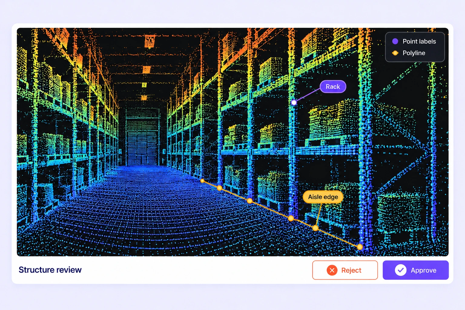
Yes. Define the required classes in the project ontology. Use oriented cuboids for object extents, spatial shapes for task-specific structures, or point segmentation for labeled regions.
Use class properties and, for frame-based scenes, changing property values. Define observable states such as loaded or unloaded in the annotation guidelines and review them against the available scene evidence.
Yes. Maintain a persistent cuboid track with keyframes and visibility ranges. Interpolation supports geometry between keyframes, while camera-guided tracking requires a suitable calibrated camera sequence. Review all generated results.
Agree on visibility and extent rules before annotation. Review the point cloud, neighboring frames, and calibrated camera images where available. Flag uncertain cases instead of silently applying inconsistent assumptions.
Use folders, tags, metadata, and available filters to organize scene recordings. Create dataset versions for selected layouts, equipment classes, and recording conditions so annotation work uses a defined selection.
Use required-property validation, expert review, standalone-scene Consensus, and hidden Quality Gate reference labels. Assign issues and review corrections before accepting the dataset for release.
Use batch view to inspect the same cuboid across multiple frames. Compare its fit against the point cloud, correct drift with editable keyframes, and review visibility changes before approving the track.
LiDAR annotations export in Unitlab Unified Export Format (UUEF), including supported spatial geometry, tracks, scene metadata, calibration, and point-label arrays. Validate the output with your model pipeline and dataset conventions.


We use cookies to improve your experience. See our Privacy Policy and Cookie Policy.